

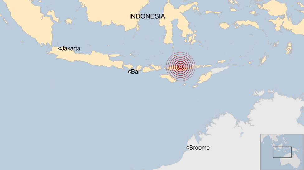
A powerful magnitude 7.7 earthquake struck Indonesia's Flores island shortly before 05:00 local time on 16 August 2026 (22:00 GMT on 15 August), killing at least 47 people and severely damaging hundreds of buildings across the region. Rescue teams spent the day combing through collapsed structures for survivors as officials warned that the full scale of the disaster remained unclear.
Indonesia's meteorology and geophysics agency, BMKG, said the quake originated at a depth of 15km. A separate magnitude 6.9 earthquake struck the other end of the Indonesian archipelago the same day, underscoring the country's position along what is widely known as the Pacific ring of fire.
Where was the damage concentrated?
The National Disaster Management Agency, BNPB, said tremors were felt as far west as Bima Regency and City, though Manggarai province bore the brunt of the destruction. Preliminary figures put the death toll at 24 in Manggarai, 17 in East Manggarai, three in Sikka, and at least one each in Ngada, Ende and West Manggarai. Officials also recorded two people seriously injured and 11 with minor injuries. According to a report from CNN, later figures put the number of injured at 50, with roughly 2,000 residents evacuated to higher, safer ground.
BNPB reported that more than 150 houses were severely damaged, alongside dozens of schools, several healthcare facilities, places of worship, government offices and other public buildings. The agency said 10,500 aid packages had already reached its base of operations, though reaching the mountainous and remote terrain of the affected districts is expected to slow further assessment and relief work.
How strong was the shaking, and where was the epicenter?
The US Geological Survey placed the epicenter roughly 68km north-northwest of the town of Ende, estimating that approximately 1.5 million people were exposed to strong to severe ground shaking. Separately, Al Jazeera reported that more than 230 aftershocks had rattled the island since the main quake, with the strongest reaching magnitude 6.2.
Footage filmed at the port in Maumere, the largest town on Flores, showed large sections of concrete breaking away from the terminal building onto passengers waiting to board an inter-island ferry, with some people thrown into the sea after a ship's gangway collapsed. East Nusa Tenggara governor Emanuel Melkiades Laka Lena told a news conference that some victims died in their sleep after being buried under collapsing rubble.

How did residents respond to the quake and tsunami warning?
Arnold Welianto, a resident of Talibura village on the Sikka coastline in East Nusa Tenggara, said he was thrown from his sleep by the force of the shaking.
"I was startled awake and immediately went to my child's room."
He said many residents had already fled into the surrounding hills after noticing the sea receding along the shoreline, a common precursor to tsunami waves. A tsunami warning was issued shortly after the quake, prompting roughly 2,000 people to evacuate on their own initiative. According to RRI, BMKG extended the tsunami alert to four provinces: East Nusa Tenggara, West Nusa Tenggara, South Sulawesi and Southeast Sulawesi.
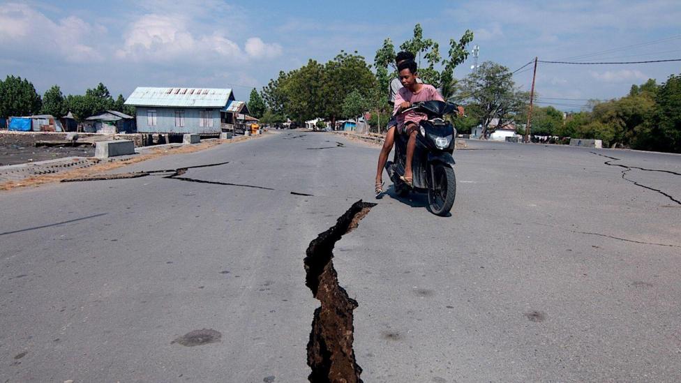
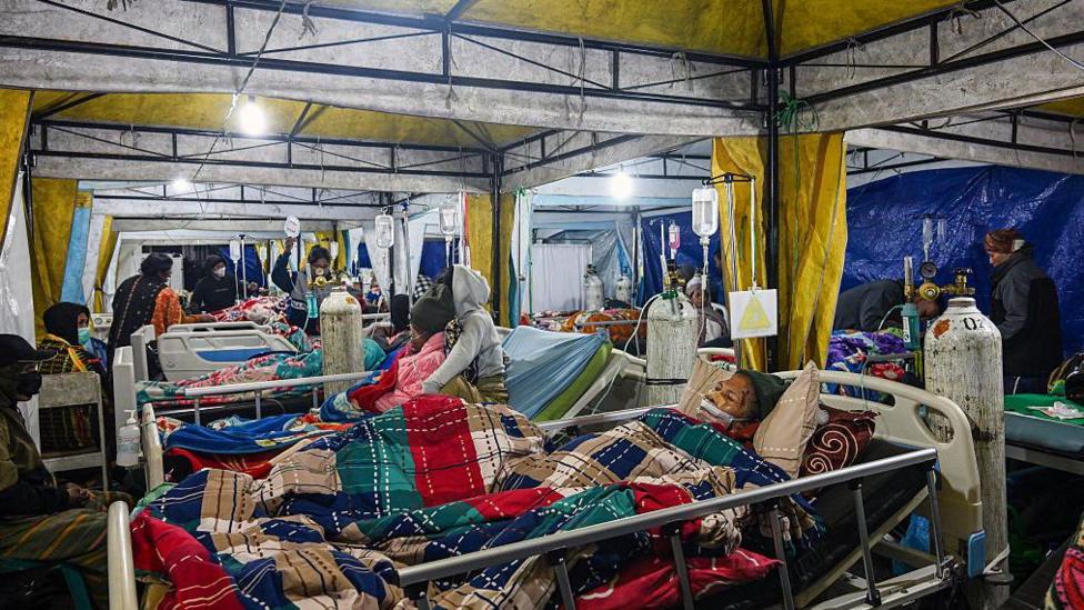
The warning was lifted around three hours after the initial jolt once monitoring showed no significant rise in sea levels. However, both NPR and reported that tsunami waves under one metre were recorded in several coastal locations before officials stood down the alert. Landslides blocked access to some villages, but rescue crews continued working through the day to free people trapped beneath rubble, and a temporary medical tent was set up outside a hospital in Ruteng to treat the injured. BNPB has urged residents to remain calm, avoid coastal areas and stay clear of structures showing visible damage.
Is this part of a wider pattern in the region?
Indonesia sits at the junction of three major tectonic plates, making it one of the most earthquake- and volcano-prone countries in the world. noted that rescue workers faced particular difficulty reaching communities closest to the epicenter because of damaged infrastructure compounded by ongoing aftershocks.
The disaster follows a string of major earthquakes across the wider Asia-Pacific region in recent months. Earlier reporting on the initial Flores earthquake recorded a lower, provisional death toll of one as rescue teams first began assessing the damage. In June 2026, a magnitude 7.8 earthquake struck Mindanao in the southern Philippines, killing at least 32 people, an event followed by hundreds of aftershocks that pushed the death toll to 37. In July, a magnitude 7.1 quake in Kumamoto prefecture, Japan, killed 13 people and damaged buildings, roads and utilities.
What happens next?
The USGS has warned that further aftershocks, some potentially strong, are likely to follow the main quake as the fault system continues to settle. BNPB and BMKG are expected to issue updated situation reports as crews complete damage assessments and confirm evacuation numbers in the coming days, particularly in the harder-to-reach mountainous districts of Manggarai and East Manggarai.
Key Facts
- Magnitude 7.7 earthquake struck Flores island shortly before 05:00 local time on 16 August 2026, at a depth of 15km
- At least 47 people confirmed dead; CNN later reported 50 injured and roughly 2,000 evacuated
- More than 150 houses and numerous schools, clinics and public buildings severely damaged
- Tsunami warning covering four provinces was lifted after about three hours; waves under one metre were recorded in some areas
- USGS estimated 1.5 million people were exposed to strong to severe shaking; over 230 aftershocks recorded


