

A magnitude 7.7 earthquake struck the Indonesian island of Flores in the early hours of Saturday morning, killing at least one person and injuring several others as residents fled into the streets of Maumere, the region's main town. Authorities issued a tsunami warning that was later withdrawn, though search and rescue operations continued as officials worked to determine the full scale of the damage.
Footage captured at the local port showed sections of concrete breaking away from the terminal building and falling onto passengers who were waiting to board an inter-island ferry. Several people were reportedly thrown into the water after the ship's gangway gave way beneath them.

How severe was the damage and casualty toll?
Indonesia's National Disaster Management Agency, known locally as BNPB, initially reported that two people had been killed before revising the figure downward. The agency later confirmed one confirmed fatality and four injuries, stating in an official release that verification work on the ground had led to the updated count.
Following verification and validation by personnel on the ground, the data was revised to one confirmed fatality.
However, according to a later update from CNBC Indonesia, BNPB subsequently raised the death toll to two, alongside reports of additional damage to homes and hotels across East Nusa Tenggara. Separately, rescue coordinators in Maumere told a national broadcaster's live coverage that two more people had been injured and that response teams had been dispatched to the hardest-hit areas, according to a report from a national broadcaster's live coverage.
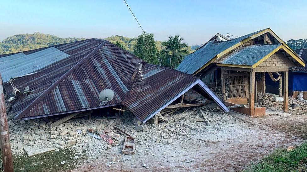
Damage assessments compiled by CNBC Indonesia pointed to collapsed walls of modest homes in Maumere, West Manggarai and Labuan Bajo, along with structural harm to the Maumere port facility and the Hotel Jayakarta Bajo, according to the same CNBC Indonesia report.
Where exactly did the earthquake strike, and how strong was it?
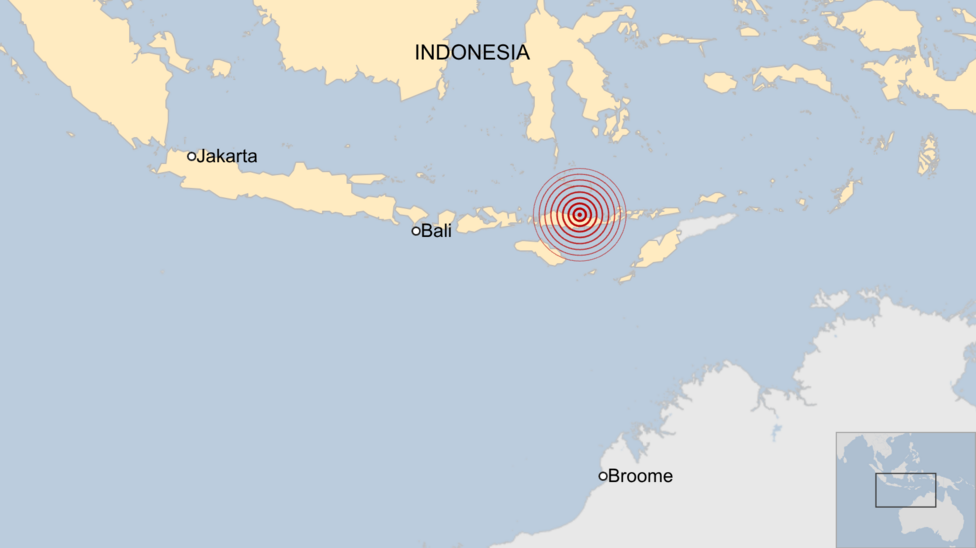
The quake struck the Flores region of East Nusa Tenggara province just before 5am local time on Saturday, with Indonesia's Meteorology, Climatology and Geophysics Agency recording a depth of 15km. The United States Geological Survey placed the epicentre roughly 68km north-northwest of the town of Ende in East Nusa Tenggara, at a shallower depth of 10km, according to the USGS event page. Indonesia's meteorological agency, BMKG, also revised the magnitude upward, from an initial estimate of 7.0 to the confirmed 7.7, according to a report from Xinhua. The USGS further estimated that approximately 1.5 million people were exposed to strong to severe shaking, and cautioned that aftershocks were likely to follow, according to the agency's executive summary. The global disaster monitoring platform GDACS classified the event as a


