

Major Earthquake Strikes Mindanao, Philippines
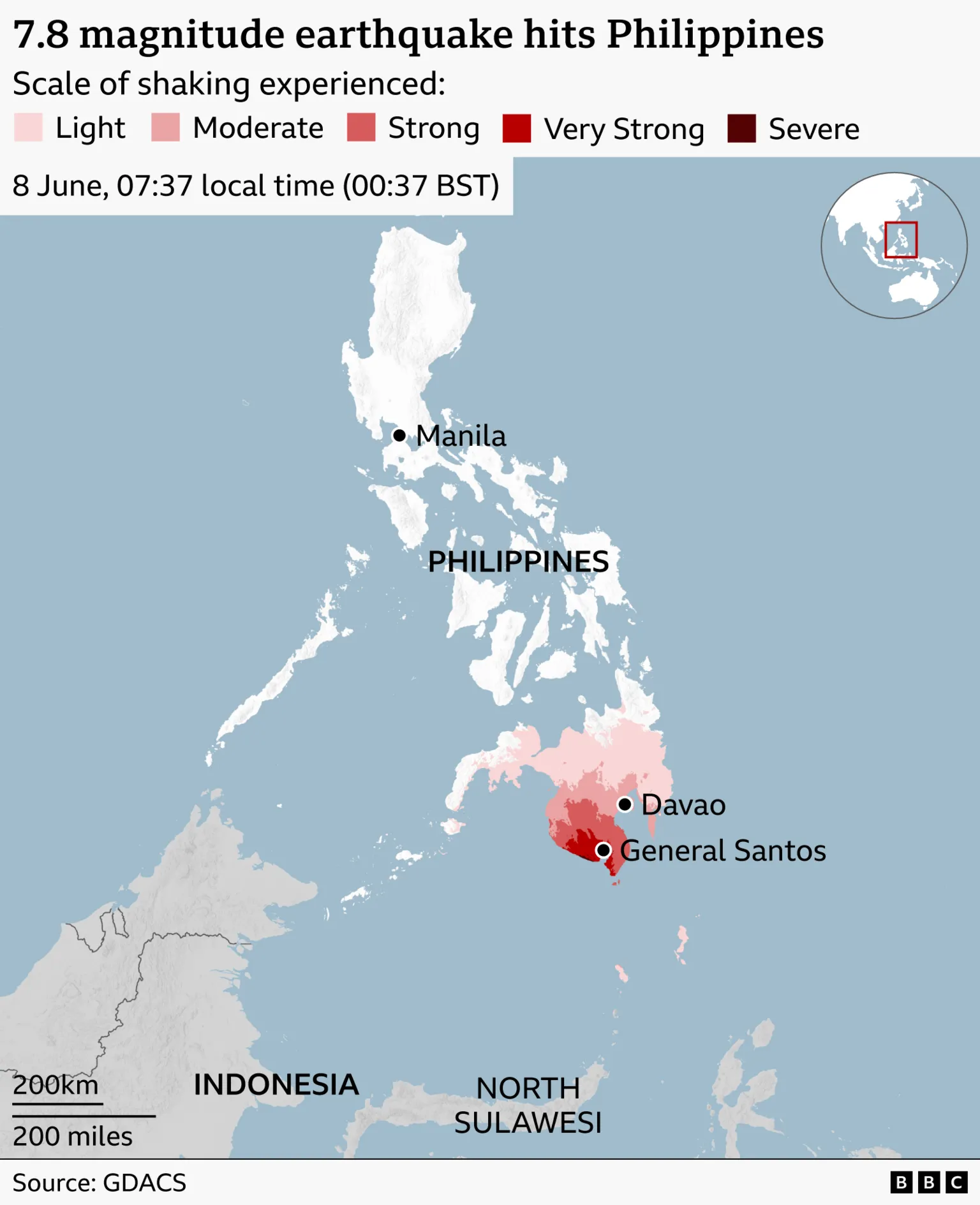
At least 32 people have died following a magnitude-7.8 earthquake that struck off the coast of Mindanao island in the southern Philippines, according to officials.
The earthquake occurred at 07:37 local time on Monday (Sunday 23:37 GMT), prompting tsunami alerts across the Philippines, Indonesia, Japan, and Australia. Some of these alerts were later cancelled hours after the event.
Videos and photographs captured the destruction caused by the quake, including footage of buildings collapsing. One notable clip showed a Jollibee fast food restaurant reduced to rubble. Additionally, landslides have been reported in several areas affected by the quake.
Authorities reported that over 100 individuals have sustained injuries across multiple provinces. Nearly two dozen people remain missing, and approximately 10,000 residents have been evacuated as a precautionary measure.
Mindanao is the Philippines' second-largest island by both size and population, with around 26 million inhabitants.
The casualty figures are still being verified by the national disaster agency, which compiles and confirms reports from various local sources. An official update is expected in the coming days.
Impact in Sarangani and General Santos
Local officials in Sarangani province, located about 20km (12.5 miles) from the earthquake's epicenter, reported 17 fatalities, many resulting from a landslide. The quake temporarily disrupted power and communication networks in Sarangani, though these services were later restored.
In General Santos, the city closest to the epicenter, 10 deaths have been confirmed by the Office of Civil Defence. Additionally, 22 people remain missing. General Santos is known as the tuna capital of the Philippines and is the hometown of world boxing champion and politician Manny Pacquiao.
The provinces of South Cotabato and Sultan Kudarat also experienced significant effects from the earthquake.

Government Response and School Closures
Philippine President Ferdinand Marcos Jr. issued a statement affirming that government agencies are coordinating disaster response efforts.
"The national government is moving and we will not leave Mindanao behind," he said.
President Marcos also ordered the suspension of classes in the affected areas following the quake, which coincided with the first day of the school year in the Philippines.
In a video posted by a primary school in Davao Occidental province, dozens of frightened students were seen squatting on the shaking ground during the earthquake. The video also showed a corrugated-roof shelter collapsing behind them; however, the school reported that no injuries occurred.
Aftershocks and Seismic Activity
More than 130 aftershocks have been recorded since the initial quake, with magnitudes ranging from 1.3 to 6.7.
Seismic Context and Previous Earthquakes
Earthquakes are common in the Philippines, which is located along the geologically active "Ring of Fire." While most earthquakes in the region are minor and cause limited damage, some have been deadly. For example, in September of the previous year, a magnitude-6.9 earthquake struck the central Visayas region, resulting in over 70 fatalities.
Tsunami Warnings and Observations
Shortly after the earthquake on Monday morning, Japanese authorities issued warnings of potential tsunami waves reaching up to one meter in height along its shores.
A tsunami wave measuring a few centimeters was later observed in Okinawa, a southern prefecture of Japan, while a 20cm (0.7ft) wave was recorded in the more distant Ogasawara Islands.
Waves were also detected along the coasts of Indonesia, Palau, and the Philippines. The heights of these waves ranged from a few centimeters to 1.4m (4.6ft), according to official reports.


