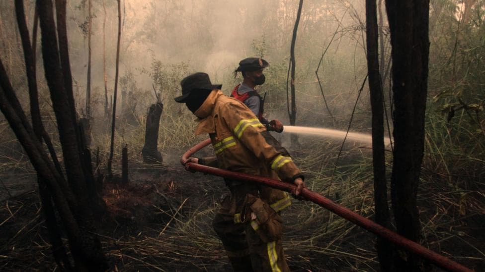
Wildfires fuelled by the developing El Niño climate phenomenon are affecting approximately 12.5 million people across Indonesia, according to the country's health ministry. Scientists monitoring Pacific Ocean temperatures have confirmed that this El Niño event has become the strongest on record, with sea surface temperatures in a critical central-eastern Pacific region reaching unprecedented levels.
On 19 September, daily sea surface temperatures in the key monitoring zone climbed to 3.05°C above the long-term average, surpassing the previous record of 3.02°C established during the exceptionally strong El Niño of 2015. According to NOAA's Climate Prediction Center, sea-surface temperature anomalies in the eastern equatorial Pacific have exceeded 3.0°C, placing the event in official El Niño Advisory status. While certain longer-term measurements of El Niño strength have not yet reached record levels, scientists expect these thresholds to be broken as the phenomenon approaches its anticipated peak later in 2026.
The Met Office's Head of Long Range Prediction, Professor Adam Scaife, commented on the significance of these developments:
We have been signalling for months that the developing El Niño will be an unprecedented event. The fact that it has already exceeded previous records – with several weeks to go before it peaks later this year – shows the enormity of this El Niño.
According to reporting on NOAA's latest assessment, the probability of a historic-strength event during October–December 2026 has been raised to 75%, up from 69% in August 2026. Additionally, NOAA indicated on 10 September 2026 that there is a greater than 90% chance of a very strong event during the Northern Hemisphere fall and winter of 2026–27.
What is El Niño and how is it measured?
El Niño represents a naturally-occurring climate pattern that emerges roughly every two to seven years and typically persists for approximately one year. The phenomenon develops when trade winds that normally blow from east to west across the Pacific Ocean weaken or reverse direction, permitting warm water to migrate eastwards. This displaced heat transfers from the ocean into the atmosphere, which can elevate global temperatures and trigger shifts in weather patterns worldwide.
Meteorologists identify El Niño's emergence by monitoring temperatures in a designated Pacific region. When these temperatures remain consistently 0.5°C above normal levels, an El Niño is formally declared. However, scientists employ different methodologies to assess El Niño's intensity.
The records that have been surpassed relate to daily measurements of sea surface temperature relative to the historical average—a metric known as the Oceanic Niño Index (ONI). Many scientists, including forecasters in the United States and Australia, also reference an alternative measurement called the Relative Oceanic Niño Index (RONI), which compares warmth in the key El Niño region against temperatures in the broader tropical ocean. This approach accounts for background warming driven by climate change. Under the RONI index, the current El Niño has not yet set a record, though additional announcements are anticipated in the coming weeks.
According to the International Research Institute's latest forecast, all 22 climate models agree that El Niño will continue strengthening, with the Niño 3.4 index reaching approximately 3.0°C in mid-September and probabilities remaining at 100% through September–November 2026 and December 2026–February 2027.

What impacts are already being felt globally?
Every El Niño event differs in character, meaning that impacts on global weather patterns are not predetermined. Furthermore, the unprecedented strength of the current El Niño does not automatically guarantee unprecedented weather impacts. Professor Scaife noted:
Scientists are still assessing whether the impacts will be in proportion to its magnitude, but we are already seeing expected effects worldwide.
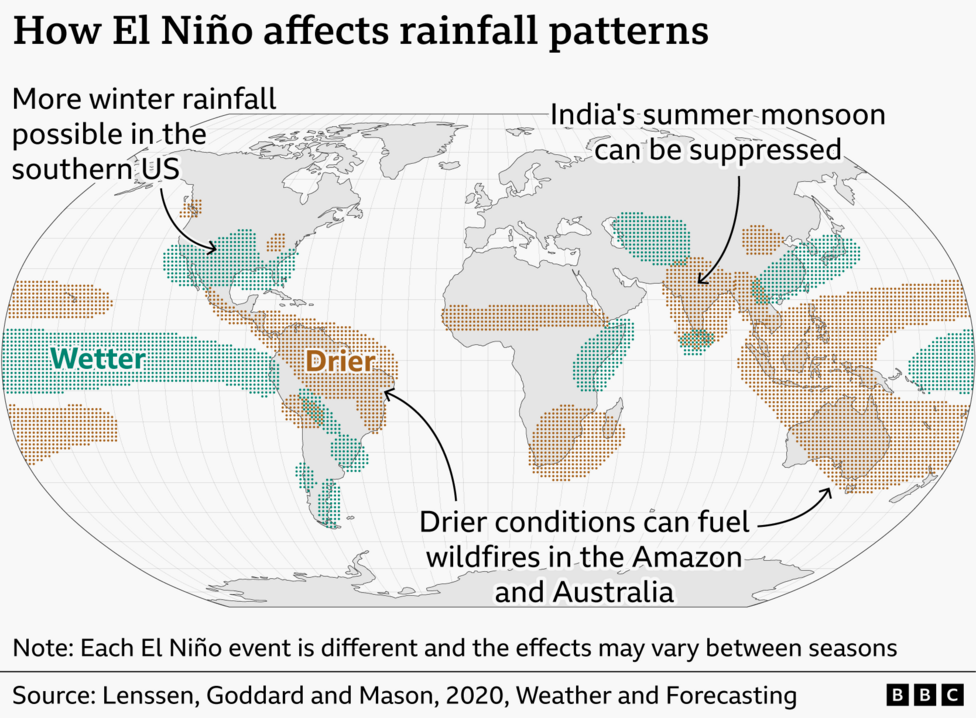
El Niño typically increases the likelihood of storms and floods in certain regions while raising the risk of drought and wildfires in others. In India, El Niño years customarily bring below-average monsoon rainfall, a pattern already evident in 2026. Data from the India Meteorological Department indicate that through 22 September, the southwest monsoon delivered 15% less precipitation than the historical norm.
A characteristic effect of El Niño involves suppressed hurricane activity in the Atlantic basin due to atmospheric wind pattern changes at high altitudes. Remarkably, 2026 has recorded no Atlantic hurricanes as of the article's reporting date, establishing a new record for the latest point in a calendar year without hurricane formation since satellite-based storm monitoring commenced.
Other anticipated effects—several of which are already materialising—encompass heightened flood risk in coastal Ecuador, Peru, and the southern United States, alongside intensified drought and wildfire threats in Brazil, Australia, and Indonesia. These meteorological impacts generate cascading consequences for agricultural productivity, food security, and economic performance across multiple continents.
How might El Niño affect the UK?
The United Kingdom's geographical distance from the tropical Pacific Ocean means that El Niño's direct effects are typically less pronounced than in other regions. Nevertheless, the phenomenon does elevate the probability of wet and stormy conditions across north-west Europe during late autumn and early winter months.
A forecast released by the Met Office during autumn 2026 identified
signals for increased rainfall and storminess in autumn here in the UK, particularly extending into November and December. The winter of 2015 and 2016, which coincided with a very strong El Niño, witnessed a succession of major storms that delivered what experts characterised at the time as the most extreme flooding on record.
Beyond storminess, El Niño can occasionally correlate with UK cold spells during late winter, though this association remains weak and historical evidence presents mixed results. The severe winter of 2009/2010, which was the coldest in three decades at that time, occurred during an El Niño phase. Conversely, the winter of 2006/2007 also took place during an El Niño year but proved unseasonably warm.
What happens next?
As this unprecedented El Niño event approaches its anticipated peak in late 2026, scientists will maintain continuous monitoring of its development and global weather consequences. NOAA's forecast window for October–December 2026 indicates a 75% probability of a historic event that would exceed all previous El Niño episodes recorded since 1950. Both NOAA and the International Research Institute project peak strength in late 2026 with continued persistence into early 2027, suggesting that the most significant impacts may still lie ahead.