
Forecasters predict a return to warmer and drier conditions across much of the UK from early next week, with temperatures potentially climbing to 25°C in parts of England and Wales—well above typical levels for this time of year. The shift will follow a period of unsettled weather characterised by rain and strong winds, offering a welcome respite before autumn weather patterns potentially become more turbulent later in the season.
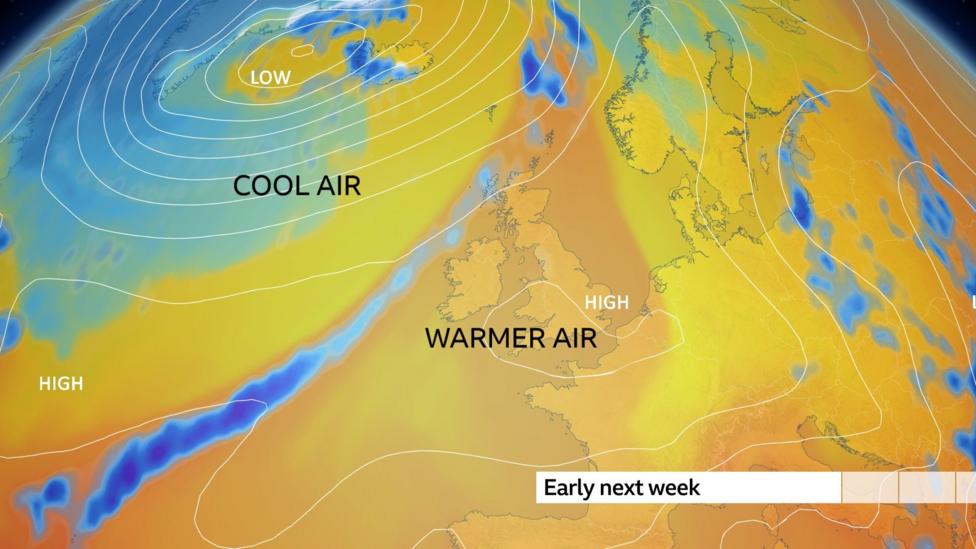
The change will be driven by an area of high pressure establishing itself near the UK, which will deflect Atlantic weather systems that normally deliver wind and rain. This blocking pattern means most regions will experience lighter winds, more sunshine, and drier conditions, though north-west Scotland will still see some rainfall as Atlantic fronts push moisture into that area.
Despite the recent wet spell, drought conditions persist across large swathes of southern Britain. According to the Environment Agency, almost three-quarters of England remains in drought, with some regions potentially staying in drought conditions through April 2027 even if autumn rainfall increases. The agency has stated that England would need 120% of typical rainfall over the next seven months for all areas to exit drought status.
What will the weather look like this weekend?
This weekend will mark a transition period as the current unsettled pattern gradually gives way to more settled conditions. Stronger south-westerly winds will push cloud and rain across the country on Friday, but this system will clear southward by Sunday.
Saturday will bring a return to sunshine and blustery showers across the northern half of the UK, with most showers concentrated in Scotland. The southern half will remain cloudier with a muggy atmosphere and a chance of light rain or drizzle. Temperatures on Sunday will peak around 22°C in southern England—unremarkable for the season.
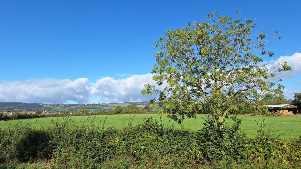
By Sunday, most places will be dry with sunny spells as the rain clears away, though west to north-west winds will remain strong in Scotland.

When will warmer weather arrive?
From early next week onwards, an area of high pressure will establish across the UK, bringing the warmer and drier conditions forecast by meteorologists. According to the Met Office's latest national outlook, the period from 21–30 September should see high pressure building across much of the UK, with drier and increasingly warm, humid weather developing while Atlantic systems remain mostly confined to the north-west.
Temperatures are expected to reach 20°C in Scotland and Northern Ireland, and as high as 25°C in England and Wales—several degrees above the average for late September. While isolated showers may still occur, most locations will remain dry throughout the week, with rain-bearing cloud systems restricted to north-west Scotland.
These temperatures fall well short of the UK's September record of 35.6°C, which was recorded in 1906 at Bawtry in South Yorkshire.
Could El Niño influence the weather later?
The current quieter spell is not being driven by the record-breaking Pacific Ocean warming associated with El Niño, but meteorologists suggest the phenomenon could influence weather patterns later in autumn. The Met Office long-range forecast indicates a higher degree of confidence that deeper areas of low pressure will affect the UK in November, potentially bringing stormy conditions. This pattern is consistent with weather behaviour typically observed during El Niño events at this time of year.
However, no two El Niño events are identical, so while the current warming episode may increase the likelihood of certain weather types occurring, outcomes are not guaranteed. The forecast for late September suggests the possibility of more unsettled Atlantic weather developing by the end of the month, following the initial high-pressure build.
Why is drought still a concern?
Despite the recent changeable weather with rain and strong winds across most of the UK, drought conditions remain entrenched in Wales and most of England. The past several weeks of rainfall have not been sufficient to reverse these deficits, which have accumulated over an extended dry period.
Meteorologists have previously noted that sustained, prolonged rainfall is essential to break drought conditions. The recent wet spell, while providing temporary relief, has not delivered the volume of water needed to restore soil moisture and groundwater levels to normal ranges. The Environment Agency continues to monitor conditions closely, with drought assessments being actively refreshed as new data becomes available.
Key Facts
- High pressure building near the UK from early next week will block Atlantic weather systems and bring drier, warmer conditions to most regions
- Temperatures could reach 25°C in England and Wales—above average for late September—while Scotland and Northern Ireland see highs around 20°C
- Almost three-quarters of England remains in drought despite recent rain, with some areas potentially staying in drought through April 2027
- England would need 120% of typical rainfall over the next seven months for all drought-affected areas to recover
- The Met Office suggests El Niño could increase the likelihood of stormy weather in November, though impacts are not guaranteed