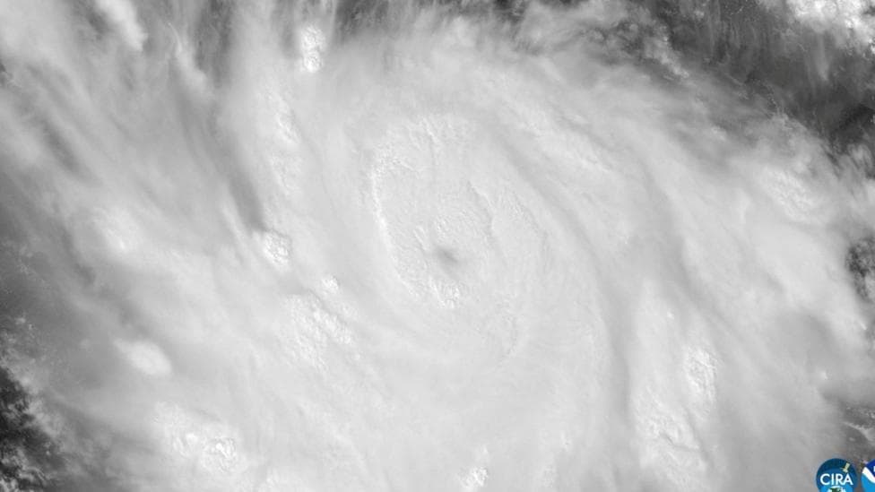
Hurricane Polo, a massive Pacific storm positioned off Mexico's southwestern coast, has been reduced from Category 5 to Category 4 status but continues to pose a significant threat, according to the US National Hurricane Center. The system represents one of the season's most intense hurricanes and is forecast to drive torrential rainfall across Mexico's Pacific coast through Thursday, though direct landfall is not anticipated.
A Hurricane Hunter aircraft operated by the US National Oceanic and Atmospheric Administration (Noaa) penetrated the storm on Tuesday and documented sustained wind speeds reaching 180 mph (285 km/h), with even more powerful gusts recorded. The storm's slow northwestward drift is being sustained by exceptionally warm ocean waters associated with the El Niño climate pattern.
The downgrade from Category 5 to Category 4 occurred on Wednesday morning. However, data collected by the Hurricane Hunter aircraft suggests Polo retains the potential to intensify further, given what Noaa described as a
"very conducive" environment of extremely warm ocean waters feeding the storm.
What rainfall and coastal impacts are expected?
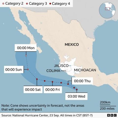
The National Hurricane Center has issued a Tropical Storm Warning from Tecpan de Galeana to Punta San Telmo and a Tropical Storm Watch extending westward to Playa Perula, according to the latest National Hurricane Center advisory. Rainfall totals of up to 6 inches (15 centimeters) are forecast across affected areas, though the National Hurricane Center warned of rainfall totals up to 12 inches in coastal Guerrero and Michoacán through Thursday.
The slow-moving system will generate torrential precipitation in Mexico's southwestern coastal regions, with forecasters warning of
"life-threatening flooding and mudslides, especially in areas of steep terrain". Residents have also been cautioned about large ocean swells and dangerous surf conditions expected to persist for several days. According to AccuWeather, rainfall totals of 4-8 inches are likely along the coasts of Guerrero, Jalisco, Colima and Michoacán, with a Local StormMax of 18 inches.

Which regions face the greatest risk?
Mexico's President Claudia Sheinbaum stated on Tuesday that
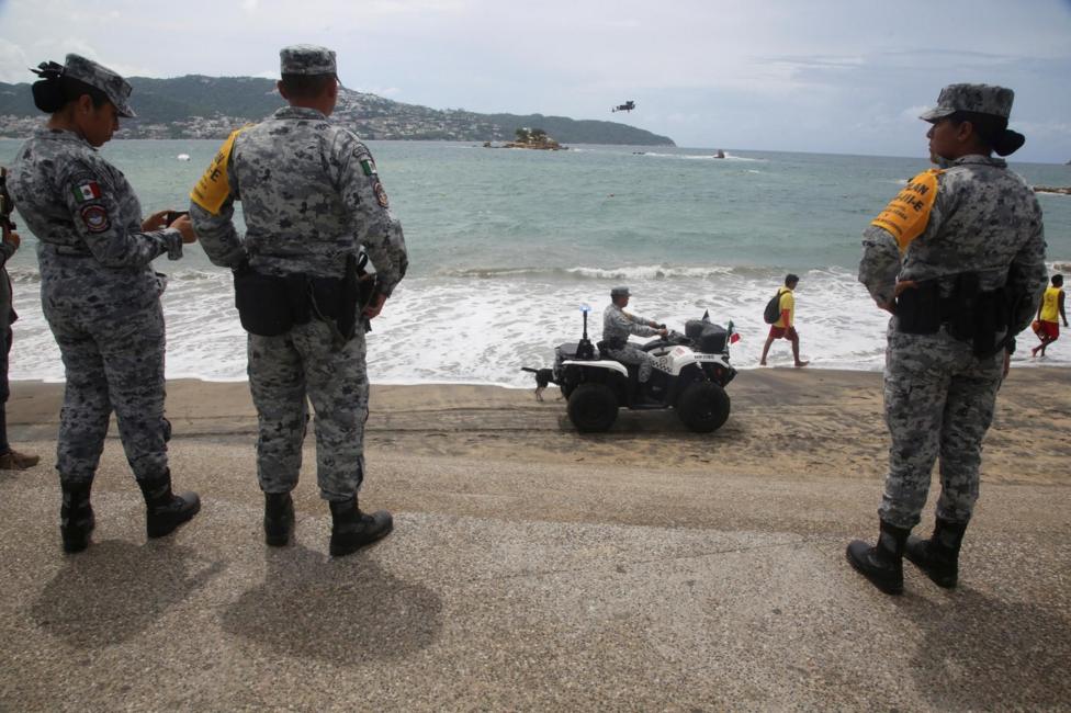
"So far, the information we have is that (Polo) will not make a direct landfall on the coast", but she urged residents along the Pacific coast to remain alert. Sheinbaum identified the states of Jalisco, Colima and Michoacán as facing elevated risk. Heavy rain and flash-flood danger remain the primary forecast concern through Thursday in Guerrero and Michoacán, with coastal impacts extending to neighboring states.
How is El Niño fueling this storm?
Polo's intensity is being sustained by the El Niño climate phenomenon, which is currently producing record-breaking ocean temperatures. Scientists tracking sea surface conditions report that the current El Niño is now the strongest on record. Daily sea surface temperatures in a critical region of the central-eastern Pacific reached 3.05 degrees Celsius above average on 19 September, surpassing the previous record of 3.02 degrees Celsius established during the exceptionally strong El Niño of 2015.
While certain longer-term measures of El Niño have not yet reached record levels, experts anticipate this will change as the phenomenon approaches its expected peak later this year. Warmer ocean waters enable storms to extract additional energy, resulting in higher wind speeds and greater intensity.
El Niño is a naturally-occurring climate pattern that emerges approximately every two to seven years and typically persists for roughly one year. The phenomenon occurs when trade winds that normally blow from east to west across the Pacific Ocean weaken or reverse direction, permitting warm water to migrate eastward. Heat released from the ocean into the atmosphere can elevate global temperatures and trigger weather pattern shifts worldwide.
What happens next?
The National Hurricane Center will continue issuing updated advisories and forecast revisions as Polo maintains its position near Mexico's coast through Thursday. Heavy rain and flash-flood risk will remain the dominant forecast concern through Thursday in Guerrero and Michoacán, with coastal impacts extending to nearby states as the system continues its slow northwestward progression.
Key Facts
- Hurricane Polo was downgraded from Category 5 to Category 4 on Wednesday morning but retains potential to strengthen
- Sustained winds of 180 mph (285 km/h) were recorded by a Hurricane Hunter aircraft on Tuesday
- Rainfall totals of 6-12 inches are forecast, with some areas potentially receiving up to 18 inches
- The current El Niño is the strongest on record, with sea surface temperatures 3.05°C above average
- Direct landfall on Mexico's coast is not anticipated, though offshore impacts will be severe