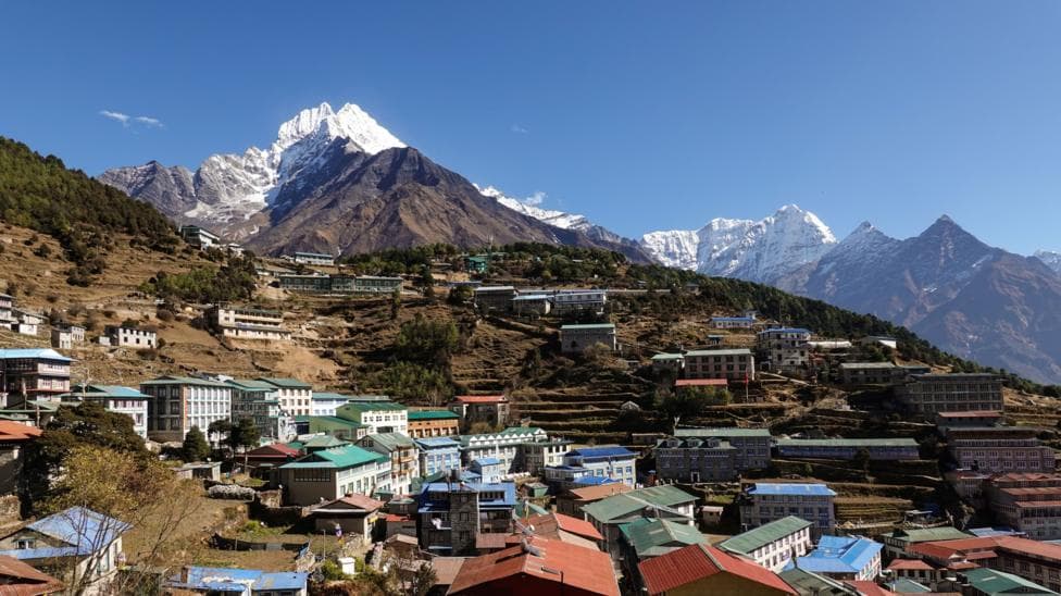
A new scientific study reveals that approximately 300,000 people across the Himalayan region now face heightened exposure to potentially catastrophic natural hazards, driven by rapid expansion of tourism and residential construction in high-risk zones. According to BBC News, researchers documented a 45% surge in built-up land across northern Nepal, south-eastern Tibet and India's Uttarakhand between 2016 and 2023, with development accelerating even faster—by nearly 78%—in areas specifically threatened by glacial lake flooding.
The peer-reviewed study, published in Scientific Reports, examined territories up to 50 kilometres downstream from Himalayan rivers and around 1,360 glacial lakes. Scientists involved in the research cautioned that the true number of people under threat could substantially exceed their findings, since they analysed only specific regions and did not assess neighbouring areas facing comparable risks. The study was completed before August's catastrophic mass flooding that killed more than 1,400 people and left thousands missing across Nepal, followed by subsequent incidents including a devastating flood along the Budhi Gandaki river on 11 October that destroyed 200 houses, swept away five bridges and left five people missing.
This expansion of human settlement in vulnerable areas reflects a broader pattern of unplanned development driven by economic pressures. Recent research indicates that Himalayan glaciers are melting 65% faster than a decade ago, with India's government identifying 56 glacial lakes as "very high risk." The crisis threatens 20% of India's GDP and hundreds of millions of people across the region.
Why is construction accelerating in dangerous zones?
Tourism development and infrastructure expansion have driven much of the recent building activity. Pokhara, a major tourism hub positioned at the foot of the Himalayas, has undergone substantial growth over the past 30 years to accommodate surging visitor numbers, with significant expansion of tourism facilities, infrastructure and real estate throughout the region.
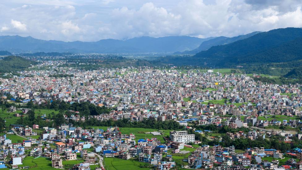
Mayor Dhana Raj Acharya of Pokhara describes the challenge posed by the Seti Gandaki River—which originates in the Annapurna mountain range and flows directly through the city—as enormous. Many older structures stand just 5 metres from riverbanks despite new regulations requiring greater setbacks.
Where we move them, and how we do that, is the real challenge.
North of Pokhara lies the world-renowned Annapurna trekking region, which has experienced substantial increases in riverside settlements, some of which have been struck by recent floods and landslides. 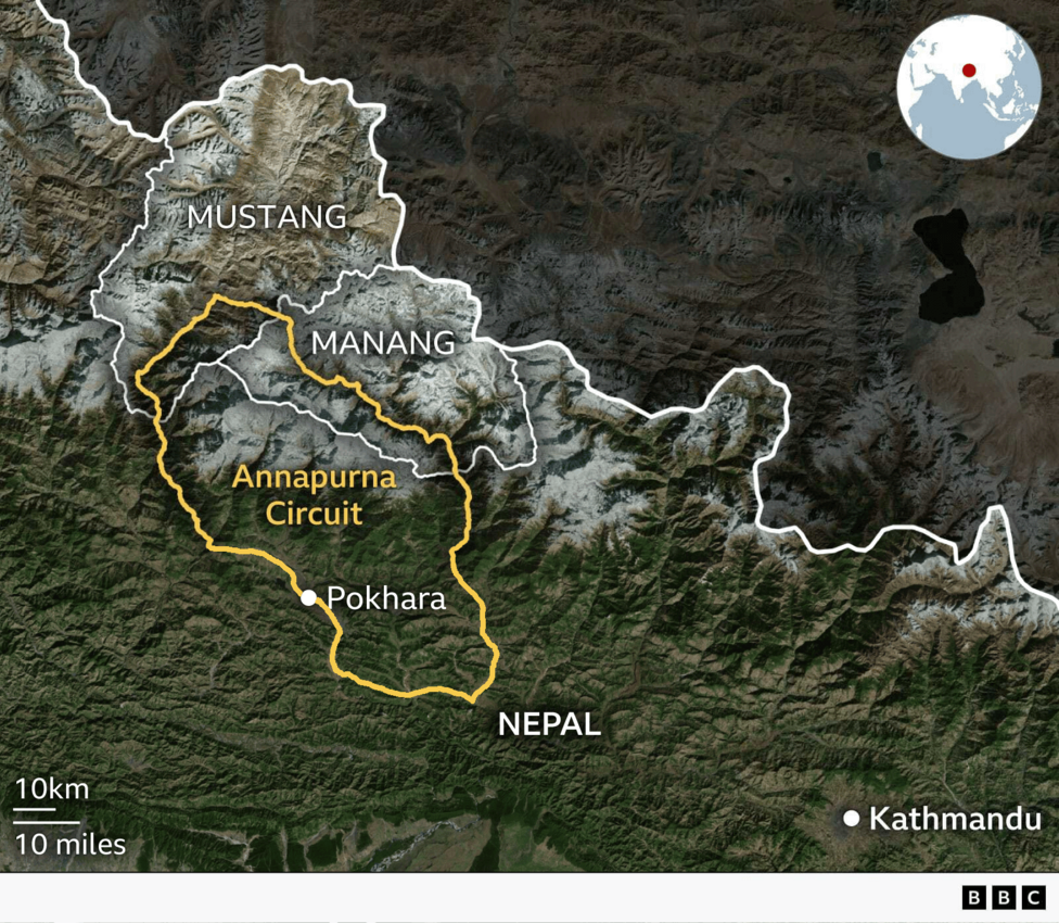
We have been doing this business for more than 40 years, but we've never seen this kind of disaster.
Krishna Gauchan, whose hotel sits near the glacier-fed Modi river, shares similar anxieties.
This river can flood if the glacier collapses or if the glacial lake bursts out and we are living in constant fear.
Tourism investors frequently market these locations as destinations without adequately accounting for natural hazards, according to Khagendra Poudel, a geographer at a local campus of Tribhuvan University. Comparable patterns are emerging in parts of northern India's Himalayan valleys that host major pilgrimage sites. The president of the Hotel Association Pokhara acknowledged that tourism businesses have expanded
without any proper planningin the region and been promoted
haphazardly. Laxman Subedi added:
By the time disasters hit, it is too late. As a professional body we are trying to create awareness among tourism entrepreneurs and investors.
Beyond tourism, the regions surrounding the Bhotekoshi and Trishuli rivers have witnessed significant growth in hydropower plant construction. The October flood alone affected four hydropower projects with a combined installed capacity of 412.09 megawatts, according to Nepal's Independent Power Producers' Association.
What makes the Himalayan region particularly vulnerable?
The escalating risks across these areas stem primarily from warming in the Himalayan region, which scientists have documented is occurring at approximately twice the global average rate. This accelerated warming has intensified the melting of glaciers, icefields, snowpacks and permafrost. A scientific study confirms that climate change significantly contributed to the glacier collapse that triggered devastating floods on the Nepal-Tibet border last month.
Accelerated glacier melt destabilizes mountain slopes, which are also frequently subjected to seismic activity, unleashing catastrophic hazards downstream. The rapid melting simultaneously fills and expands glacial lakes until they rupture, generating deadly floods. Nepal has documented approximately 30 such events since 1940. Rising temperatures also cause precipitation to reach high altitudes where it previously fell only as snow, triggering slope failures, rock and ice falls, and other disasters.
The World Meteorological Organization reports that recorded disasters in the region rose from 864 in 1986–2005 to 1,148 in 2006–2025, reflecting the accelerating frequency and severity of hazardous events. A preliminary assessment by Nepal's Department of Mines and Geology attributed the 11 October flood to an avalanche and landslide that blocked and then released water in the Ungdilung Khola, with the largest surge estimated at 20–25 metres. The avalanche began at approximately 6,000 metres and the landslide occurred at about 5,500 metres, with the largest surge reaching the hydropower camp at Salleri around 6:30 a.m.
Nepal's Prime Minister Balendra Shah highlighted the dangers of climate change during his recent UN General Assembly address, stating that his country was paying a
colossal pricefor a crisis it did not create.
Every major disaster threatens to erase years of development. And it forces a poor country to borrow money to repair damage it did not cause.
How extensive is the actual risk?
The study categorised buildings at risk as all those positioned within 50 vertical metres of a river or glacial lake's surface. However, during the catastrophic flooding on 26 August, residents in Rasuwa district reported that river levels had risen by 70 metres at certain locations—meaning even structures relatively distant from riverbanks were struck and buried by debris-laden sludge.
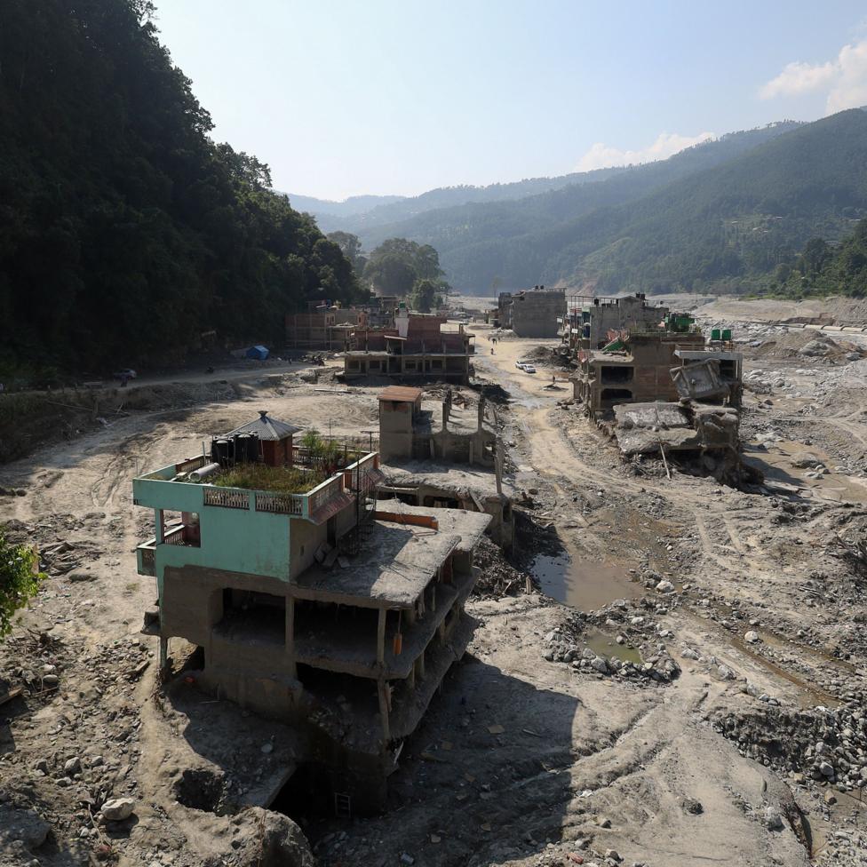
C Scott Watson, a glaciologist at the University of Leeds and lead author of the study, warned that
as river valleys become increasingly populated, development decisions being made today will shape disaster risk for decades to come.Alton Byers, a mountain geographer at the University of Colorado who was not involved in the study, characterised it as a
springboardto drive more effective early-warning systems and other precautionary measures.
Why aren't building regulations preventing this development?
Achieving meaningful risk reduction will prove challenging, as campaigners emphasise that building regulations are frequently not enforced on the ground and development has been haphazard across too many locations. Roads, hydropower projects, hotels and market towns have proliferated on low, flat land adjacent to rivers—terrain that is accessible and easily buildable—according to Prof Surya Raj Acharya, an urban planning expert and registrar at the University of Nepal.
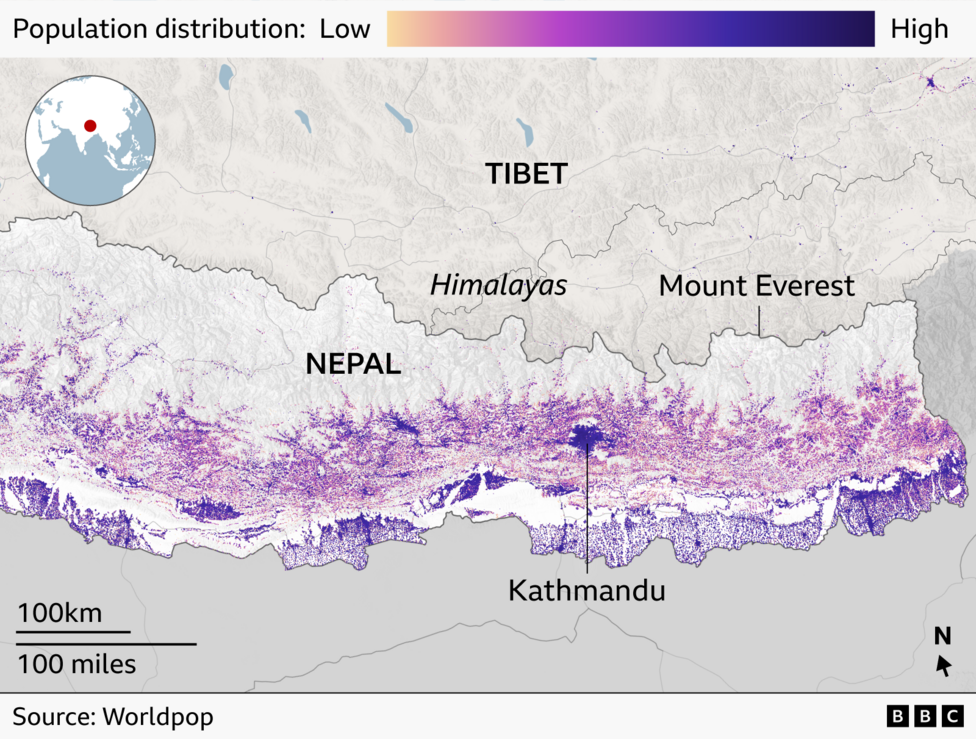
Those responsible have routinely disregarded safeguards including maintaining distance from riverbanks.
A fragile ecosystem like the Himalaya demands stricter planning and building regulations than elsewhere, yet these rules have been weak and poorly enforced.
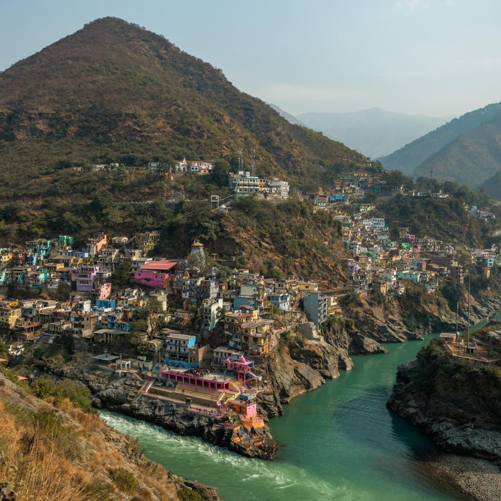
Comparable challenges exist across Nepal's western border in India's Uttarakhand state, where maximum tourism limits and environmental regulations have been circumvented in pursuit of economic growth, according to activist Anoop Nautiyal. Although zoning rules theoretically prohibit construction of houses and infrastructure too close to river banks,
on the ground we see no implementation of such rules. You can see rampant construction all over.
Basanta Raj Adhikari, director of the Centre for Disaster Studies at Tribuvan University, contends that completely mitigating such threats will not be feasible. He proposes that insurance grading could provide an alternative mechanism to incentivise construction in less hazardous areas. If authorities were to designate locations as high, moderate and low risk, he believes insurance coverage would
follow accordingly, ensuring that people constructing homes in safer zones receive superior protection.
What steps are authorities taking?
Authorities in Nepal have stated they are working to address these challenges. Settlements positioned within 15 metres of riverbanks along the recently devastated Rasuwa-Bhotekoshi corridor will soon face prohibition, according to the national disaster agency. Comparable regulations are being introduced in other river corridors in the near term.
It is a challenging job because people in many places have sentimental attachments with their land and property but we cannot ignore the increasing risks,says Dharam Raj Uprety, chief executive of the national disaster agency.
The Uttarakhand government approved new floodplain zoning rules on 12 October to regulate land use and development.
Its objective is to protect life, property and important infrastructure from possible flood damage while maintaining the natural flow of flood waters,the state's cabinet decision stated.
A major flood-generating event struck the same Budhi Gandaki valley in April 2024, when an ice avalanche from the Manaslu Glacier entered Birendra Tal and triggered an overflow into the river. The International Centre for Integrated Mountain Development identifies glacier retreat, thawing mountain permafrost and slope destabilisation associated with a powerful earthquake more than a decade ago as factors that may contribute to ongoing instability in the region.
What comes next?
Nepalese authorities and the International Centre for Integrated Mountain Development are investigating the October flood's trigger and assessing damage. The initial explanation centres on a possible failure of a temporary landslide blockage, though this remains a preliminary finding rather than a confirmed conclusion. Despite regulatory efforts and growing awareness among some stakeholders, the pace of construction across the region currently shows no signs of decelerating, suggesting that the gap between policy and implementation will remain a critical challenge in the years ahead.