

England recorded just 6.5mm of rainfall in July 2026, only 10% of its long-term average for the month, making it the driest July since national records began in 1836. Wales also registered its driest July on record, while Northern Ireland saw its eighth driest, and Scotland—though not setting a new record—received just 69% of its typical July rainfall.
The dry spell hit southern England hardest, with some areas along the Sussex coast recording less than 0.2mm of rain across the entire month. The resulting depletion of soil moisture allowed ground temperatures to climb into the high 30s Celsius in affected regions.
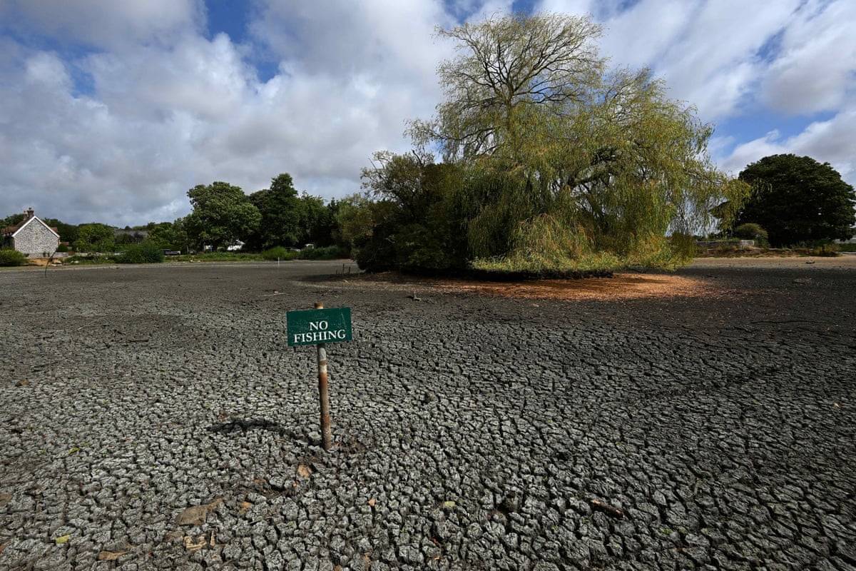
How dry was this July compared with history?
England's previous record for the driest July stood at 13.4mm, set in 1911—meaning this year's total was less than half that figure, according to the Met Office. Wales fared similarly badly, recording 9.3mm of rain, roughly 9% of its normal monthly average, per the same Met Office figures. Across the UK as a whole, rainfall reached only 35% of the July average, marking the country's driest July since 1868, according to . The same report noted that England also experienced its sunniest month ever in July, compounding the dryness. Separately, Wales posted its joint hottest July on record, with a mean temperature of 17.8C tying figures from 2006 and 1983, as reported by the Independent.
Nineteen English counties—including Greater London, Kent, Surrey and West Sussex—recorded 1mm of rainfall or less across the whole of July, according to reporting cited by a national newspaper. That extreme dryness builds on a trend flagged earlier in the summer, when England and Wales were already tracking toward a record-dry July amid relentless heatwaves and rising wildfire risk. By early August, half of England and the whole of Wales had been placed under official drought status, according to a report citing Met Office conditions.
The scale of the shortfall was becoming apparent even before the month ended: in the final week of July, England received just 7% of its long-term average rainfall for that period, according to Environment Agency figures, putting the month firmly on course for a record low. That trajectory was consistent with earlier coverage noting that southern England's driest July in nearly 200 years was already straining water supplies, farmers and wildlife. One striking local example came from Surrey, where the village of Wisley logged 50 consecutive days without rain during the same stretch, as heat health alerts spread across much of England.

Will conditions improve through August?
Little immediate relief is expected, particularly across the south. While the north of Britain has seen notable rain, parts of southern England may see only occasional showers for the remainder of August. Forecast models had repeatedly suggested unsettled weather might reach the south-east at a 10-day range over the summer, but as those windows approached, the rain consistently stayed confined to the north-west, sparing the south-east any significant relief. Given the uncertainty built into these forecasts, a continuation of this pattern cannot be ruled out. Adding to that outlook, the Met Office indicated after its 3 August update that little rain was forecast for the following week, according to a report from a South African broadcaster, suggesting the dry conditions were likely to persist in the immediate term.
What is happening with tropical storm activity in the Atlantic?
Meteorologists are also tracking a disturbance in the Atlantic roughly 1,000 miles east of the Lesser Antilles. The National Hurricane Centre has put the probability of this system developing into a short-lived tropical depression within 48 hours at 80%. Should it strengthen further, it would become the fourth named storm of the 2026 Atlantic hurricane season and would be designated Dolly. Independent of whether the system organises into a named storm, the Lesser Antilles face a risk of gusty winds and heavy rain on Friday night into Saturday. This year's strong wind shear is expected to suppress overall hurricane activity across the Atlantic basin.
How severe is the flooding from India's monsoon?
In India, the ongoing monsoon has caused significant loss of life and displacement, particularly in the eastern state of Assam, where flooding has killed 100 people as of 10 August 2026. Rivers overflowing their banks have displaced 700,000 people across the region over the past month, including 300,000 people driven from their homes near the Brahmaputra, one of Asia's largest rivers.
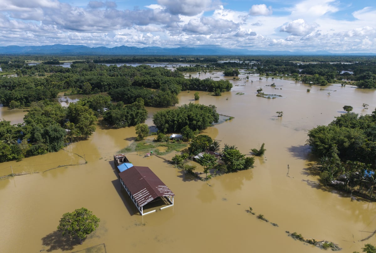
The monsoon has also brought severe lightning strikes, which killed 14 people in eastern India on 4 August 2026, including ten deaths in the district of Giridih. Many of those killed were farm labourers caught in open fields, where there was no shelter available to protect them when the storms struck.
What happens next?
The Environment Agency's weekly dry-weather and drought reporting cycle is set to continue, with its most recent published report covering conditions up to 30 July 2026. Further updates are expected to clarify whether drought status will be extended to additional areas of England and Wales as August progresses, particularly if the forecast light-shower pattern in the south fails to materialise into more substantial rainfall.
Key Facts
- England recorded 6.5mm of rain in July 2026—about 10% of its long-term average—its driest July since records began in 1836.
- Wales recorded 9.3mm, roughly 9% of its normal July rainfall, and tied its hottest July on record at a mean of 17.8C.
- England's prior record low of 13.4mm, set in 1911, was more than double this year's total.
- Nineteen English counties, including Greater London, Kent, Surrey and West Sussex, received 1mm of rain or less in July.
- Assam flooding has killed 100 people and displaced 700,000, including 300,000 near the Brahmaputra river, as of 10 August 2026.


