India’s monsoon is in danger and hotter, drier conditions are forecast across much of the world as a stronger El Niño weather system takes hold, weather experts have warned. The El Niño system is expected to strengthen from August to October, bringing higher temperatures globally, with increased rainfall in some regions and drought in others, according to new data released by the World Meteorological Organization (WMO) on Friday.
Temperatures have already shocked scientists this year and are set to intensify: the WMO said temperatures were likely to exceed 2.9C above normal in several regions. The risk of a weakened monsoon, which brings the rain on which Indian farmers rely, was highlighted as the forecast showed an “enhancement in the probability for below-normal rainfall”, which would increase drought, flood and wildfire risk around the Indian Ocean basin. Drier conditions are also likely across parts of equatorial Africa to the west of the Horn of Africa, across the south and east of Australia, large parts of South America and in North America.
Higher than normal rainfall is expected in southern Europe, central Asia and the Horn of Africa and south-eastern South America.
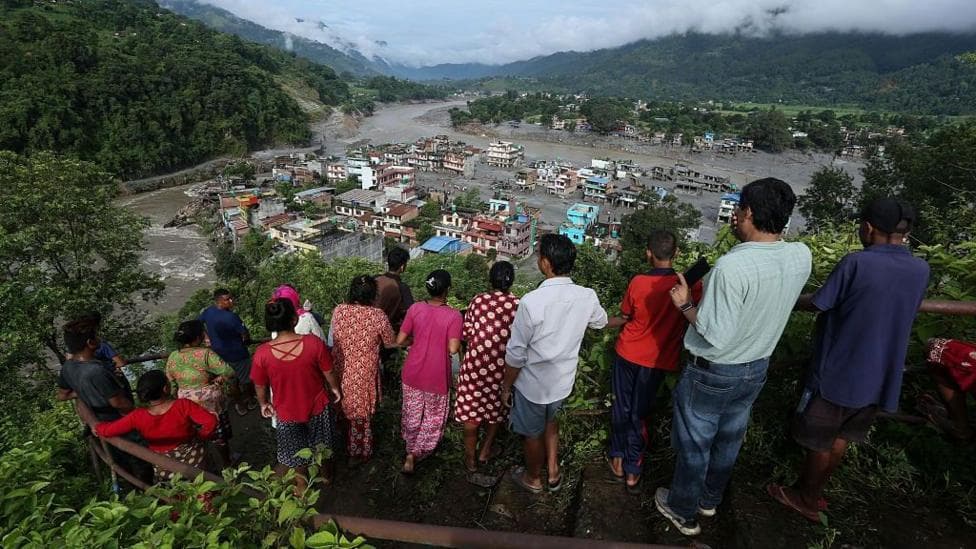
Extreme weather has already caused havoc around the world this summer, with heatwaves beginning in May in the UK, and floods that have destroyed villages and caused hundreds of thousands of people to be displaced.
This year has seen the development of an El Niño, a weather system in the Pacific that frequently affects temperatures and rainfall around the world. Some El Niño years in the past have been relatively mild, but scientists have said that this year’s has been supercharged by the climate crisis.
Warmer waters – earlier in the year than usual and with water temperatures still increasing – have led to predictions of a “super El Niño” forming. The WMO does not use this term, but has warned that the weather system developing is likely to be significantly stronger and more intense than usual. Friday’s forecasts were the organisation’s latest update, covering August to October.
Celeste Saulo, the secretary general of the WMO, called on governments to make preparations to help people affected by the heat, drought and potential floods that are likely in the months ahead.

“El Niño is one of the most closely monitored climate phenomena in the world,” she said. “But forecasts in themselves do not prevent hazards, people do. This El Niño, developing against the backdrop of unprecedented ocean heat and rising temperatures, provides governments and communities with a window of opportunity to anticipate risks and act before impacts unfold. The decisions we make today will shape the impacts we experience tomorrow.”
António Guterres, the UN secretary general, warned of the impacts on Friday and called for governments to take action on fossil fuels.
“Two months ago, I warned that El Niño was arriving on our doorstep. Now it is inside the house, and turning up the heat,” he told reporters in New York.
“The Pacific waters driving it have never been this warm this early in an El Niño, and temperatures are still increasing,” he said. “[This year] risks shattering every seasonal record, and driving even more severe effects worldwide. We are in uncharted territory.”
He warned particularly of the risks to workers.
“Heat is claiming lives on a growing scale, day after day, in every region of the world. It is also putting an enormous share of the global workforce at risk, exposing billions of people to dangers and often life-threatening conditions,” he said.
Separately, studies have shown that the and the , have been “supercharged” by the climate crisis.
What does the forecast mean for India’s monsoon?
The forecast raises the probability of below-normal rainfall, which could weaken the monsoon that Indian farmers depend on. That would increase drought risk, along with flood and wildfire risk around the Indian Ocean basin.
Which regions are likely to be drier or wetter?
Drier conditions are likely across parts of equatorial Africa to the west of the Horn of Africa, across the south and east of Australia, large parts of South America and in North America. Higher than normal rainfall is expected in southern Europe, central Asia and the Horn of Africa and south-eastern South America.
Why are scientists so concerned this year?
Scientists say this year’s El Niño has been supercharged by the climate crisis, with warmer waters arriving earlier than usual and temperatures still rising. The WMO says the developing system is likely to be significantly stronger and more intense than usual, even though it does not use the term “super El Niño”.
What are global officials urging governments to do?
Celeste Saulo said governments should prepare to help people facing heat, drought and possible flooding in the months ahead. António Guterres called for action on fossil fuels and warned that workers face rising risks from extreme heat.
Key Facts
- The WMO forecast, released on Friday, covers August to October.
- The El Niño system is expected to strengthen from August to October.
- The WMO said temperatures could exceed 2.9C above normal in several regions.
- Below-normal rainfall could threaten India’s monsoon and raise drought, flood and wildfire risks.
- Countries in multiple regions are being warned to prepare for heat, drought and flooding.