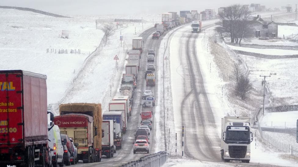
Speculation about widespread snow driven by a disrupted polar vortex heading towards the UK this autumn and winter has circulated widely, but the reality involves multiple interconnected atmospheric systems and considerable uncertainty.
While headlines have attributed potential snow to El Niño's effects, the relationship is far more nuanced. During the remainder of autumn, El Niño actually raises the probability of wet, mild conditions and potentially stormy weather across the UK. Only later in the winter season could the pattern shift towards colder temperatures and snow, a transition that might be influenced by changes in the polar vortex—though no outcome is assured.
According to the Met Office's 5 October review, current forecasts do not indicate widespread low-level snow in the coming days, and any possible polar-vortex effects linked to El Niño would represent a late-winter risk rather than a prediction of snow at specific UK locations.
What is a polar vortex?
A persistent band of exceptionally strong westerly winds circles the North Pole throughout winter, positioned approximately 10 to 30 miles (16 to 48 kilometres) above the Earth's surface. This is the polar vortex.
Formation occurs because air in the stratosphere directly above the Pole becomes extraordinarily cold and dense during winter months. The temperature differential between this frigid polar air and the comparatively warmer air at lower latitudes generates the intense stratospheric winds that constitute the polar vortex.
This phenomenon exists in the stratosphere, a layer far removed from the troposphere—the atmospheric zone where weather systems actually develop and affect surface conditions.
When the polar vortex remains robust and stable, it typically reinforces a strong polar jet stream in the troposphere below. This configuration propels systems of low pressure from west to east, channelling mild Atlantic air across the UK accompanied by periods of wind and rain. The coldest air masses remain effectively confined to regions north of the British Isles.
However, the polar vortex does not always maintain its strength and stability. Occasionally it can wobble, weaken, or even reverse its direction of rotation.
When such disruptions occur over days and weeks, their effects can propagate downward through the atmospheric layers, eventually reaching and reshaping the jet stream. The jet stream may weaken, develop more pronounced bends, or even reverse direction. Such changes can usher in colder northerly or easterly winds capable of delivering the UK's most severe winter weather.
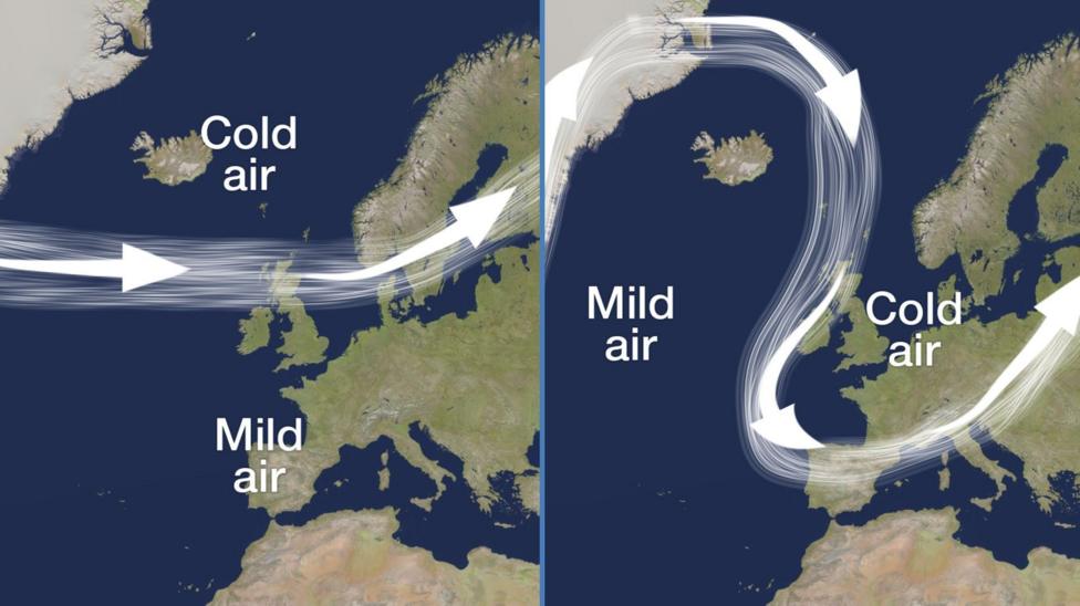
Yet these upper-atmosphere disturbances do not invariably translate into observable changes in surface weather patterns. Conversely, periods featuring a winding, meandering jet stream and cold winter conditions frequently emerge without any significant disruption to the polar vortex itself.
How does El Niño influence these patterns?
El Niño, a naturally-occurring climate oscillation centred in the Pacific Ocean, is currently intensifying and has already reached record strength by certain measurements. The enormous quantity of heat released from the warm Pacific waters into the atmosphere propagates weather impacts across the globe.
During autumn months, El Niño elevates the likelihood of wet and stormy conditions in the UK—a pattern reflected in seasonal forecasts. As winter progresses into its later stages, the atmospheric energy waves generated by El Niño can propagate upward through the stratosphere, potentially destabilising the polar vortex and thereby increasing the probability of ice and snow.
The scientific evidence linking El Niño to polar vortex disruption and UK winter snow remains ambiguous and inconsistent. Historical examples illustrate this complexity. The so-called Big Freeze of 2009 and 2010, which brought the coldest winter in thirty years at that time, coincided with an El Niño episode. By contrast, the 2006 to 2007 winter also occurred during an El Niño phase yet delivered unseasonably warm conditions. The Beast from the East in 2018, which brought severe cold and snow, actually developed during a La Niña year—El Niño's opposite phase.
According to NOAA's 2 October ENSO discussion, the probability of a historic El Niño during October through December 2026 stands at 75 per cent, defined as a three-month reading of at least +2.5°C above the baseline. NOAA's experimental October predictions indicate El Niño may be nearing its peak, with weakening expected by early winter, with a projected return to neutral conditions in spring or early summer.
While El Niño is already producing substantial impacts on global weather patterns and may influence the polar vortex during late winter, the occurrence of snow and ice across the UK remains far from certain. Current forecasts suggest that no significant cold spells or snow are probable in the immediate future.
What happens next?
NOAA's experimental seasonal predictions, issued on 1 October, extend through 30 September 2027 and will track the projected evolution of El Niño and the possible transition to neutral conditions. These forecasts will provide updated guidance on how the current El Niño episode may evolve and whether late-winter atmospheric conditions could favour polar vortex disruption and associated cold weather patterns.