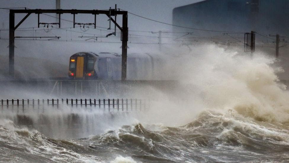
Scotland is preparing for the arrival of Storm Boelo, with train services being cancelled and police urging the public to avoid unnecessary journeys as the second major weather system in as many days approaches the country. According to BBC News, heavy rain and strong winds are expected to sweep across the nation, with wind gusts forecast to reach 80mph in exposed coastal areas.
The Met Office has issued a yellow weather warning covering most of Scotland from midday on Saturday, with a more severe amber alert in place from 21:00 on Saturday until 21:00 on Sunday, affecting the mainland and Western Isles. The amber warning is unusual because of both its duration and the extensive geographical area it covers. Forecasters have warned that the storm could cause injury, flying debris, power cuts and structural damage to trees and buildings. This follows closely on the heels of Storm Austen, which battered the UK with 70-80mph winds and heavy rain on Friday.
The severity of the situation prompted the Scottish government to convene its resilience room on Friday to ensure the country is adequately prepared for the severe weather event.
What wind speeds and rainfall are expected?
Storm Boelo, pronounced "Boo-loh" according to the Met Office, will bring very strong westerly winds with widespread gusts of 60-70mph across the warning area, intensifying to 80mph in exposed coastal locations. The strongest winds will initially strike western Scotland and the far north of Northern Ireland on Saturday evening before spreading eastwards overnight and continuing through Sunday. Periods of heavy rain and frequent showers will accompany the wind, with the Met Office forecasting 20–40 mm of rain widely in the warning area, with 60–80 mm possible in some locations. Winds will gradually ease from the west as Sunday progresses.
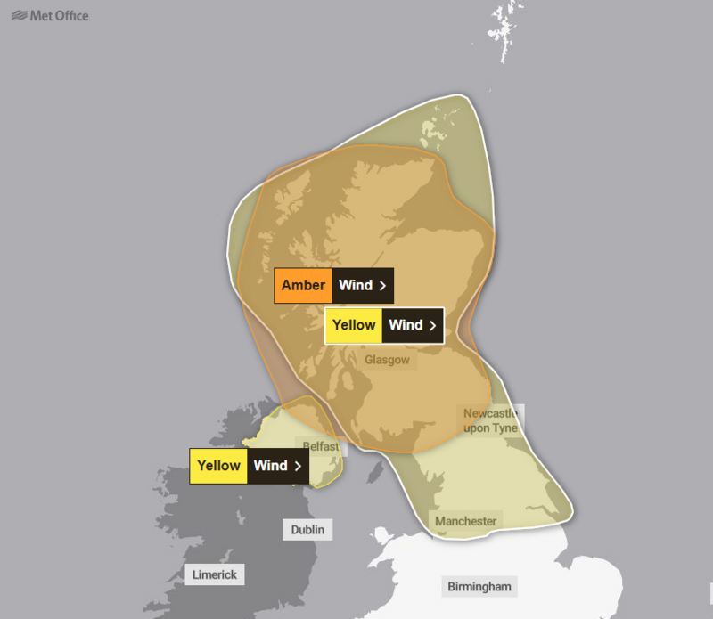
Forecasters have warned that flying debris poses a significant risk of injury and danger to life, with a substantial likelihood of power cuts and disruption to phone coverage. The Met Office also cautioned of damage to trees and buildings, potential bridge closures and widespread transport disruption.
What are the travel restrictions?
Public transport will continue to operate, though ScotRail has confirmed several train service cancellations. The Glasgow Central to Ayr line will close between Kilwinning and Ayr from 21:00 on Saturday. The Glasgow Queen Street to Oban and Mallaig line will close between Fort William and Mallaig and between Crianlarich and Oban from around 22:00. The Inverness to Kyle of Lochalsh line will close between Kyle of Lochalsh and Achnashellach from the start of service on Sunday, while the Inverness to Wick and Thurso line will close between Helmsdale and Wick or Thurso from the start of service on Sunday.
Network Rail has indicated that trains will operate at reduced speeds across large parts of Scotland from Saturday night into Sunday. National Rail's latest update indicates that weather-related disruption may affect train journeys until Monday 26 October, with some disruption possible even after warnings end. Passengers should expect significant disruption and longer journey times, and are advised to check services before travelling.
Superintendent Andy Barclay, deputy head of road policing for Police Scotland, warned drivers that conditions may be hazardous and urged them to carefully consider whether journeys were truly necessary over the weekend. He highlighted that stopping distances can be at least double on wet roads compared to dry conditions, and that spray can substantially reduce driver visibility. HGV and bus drivers have been advised to drive with extreme caution and be prepared to be directed to park at a suitable location by police if necessary. Those who must travel are urged to drive to the conditions and allow extra time for their journey, while staying tuned to media outlets for updates and consulting the Traffic Scotland website and social media channels for information about affected roads.
For coastal areas, the Royal National Lifeboat Institution has stated that weather conditions pose a serious safety risk to visitors and has advised extreme caution for anyone near the shoreline, particularly along exposed cliffs, seafronts and piers. Michael Avril, the charity's water safety lead, urged people to maintain a safe distance from the water as conditions could knock them off their feet or wash them into the sea.
CalMac cancelled a number of sailings on Friday and has amended the Saturday timetable for MV Isle of Mull, which operates between the mainland, South Uist and Barra.
Will sporting and community events be affected?
Some events may be postponed during the stormy conditions. The Scottish Cup tie between Penicuik Athletic and Clyde on Friday was among the first fixtures to be delayed due to heavy rain. Western Isles Council has advised that events including church services should be aware of strong winds throughout Sunday and has recommended they plan accordingly.
Paisley's popular Halloween festival, scheduled for this weekend and featuring a parade, street theatre and outdoor light installations, will proceed with Friday's programme as planned according to Renfrewshire Council. However, an update on Saturday's events will be provided closer to the time. A Halloween family fun day at Dean Park Castle and Country Park in Kilmarnock, originally scheduled for Sunday, has been postponed due to the weather warning.
What happens next?
The Met Office's longer-range outlook suggests that further rain and strong winds are likely at the beginning of next week, with drier and calmer conditions possible toward the end of October. Passengers and the public are advised to continue monitoring weather updates and official transport announcements as the situation develops.