

A new report into ground movement in the former Clackmannanshire mining village of Coalsnaughton has found that a large area of the site has subsided by almost 2ft (60cm) since 2018. A total of 256 residents in four streets were moved out of their homes after ground movement was discovered in May, and an eight-week investigation by the Mining Remediation Authority (MRA) has now confirmed the issue is linked to historical mining work.
What did the investigation find?
The MRA's investigation summary, external said it had concerns about previous ground treatment in 2008, which had only provided "partial mitigation." The authority said further investigations to determine the next steps would be carried out over the next few weeks.
The report said:
"The evidence reviewed indicates that the most probable primary cause is subsidence linked to historical coal mining beneath the site. "Several worked or potentially worked coal seams have been identified, and previous ground treatment appears to have provided only partial mitigation."
Work was carried out in 2008 on the site by a third party to ensure it was safe for housing. The MRA said this work involved grouting, using a mixture of cement and pulverised fuel ash, with the aim of treating abandoned mine workings and a related shaft.
The report said a review of the available previous records suggested that
"only very limited grout, if any, was taken into the ground at most borehole locations."
It added:
"Due to the presence of multiple worked coal seams, including at depth, and the relatively shallow grouting with very limited grout take, the MRA and technical specialists have identified concerns about the effectiveness of the previous ground treatment at the site."
The MRA said other possible causes, including
"shallow infrastructure failure, shallow landsliding, near-surface bedrock slip and wider geological movement"had been investigated
"but are considered less likely based on the available data".
How was the site examined?
The MRA said its investigation included CCTV surveys of site drainage, ground-penetrating radar, and boreholes up to 21m (68.8ft). It said survey data had been used to assess changes to ground levels between 2018 and May this year.
The report said:
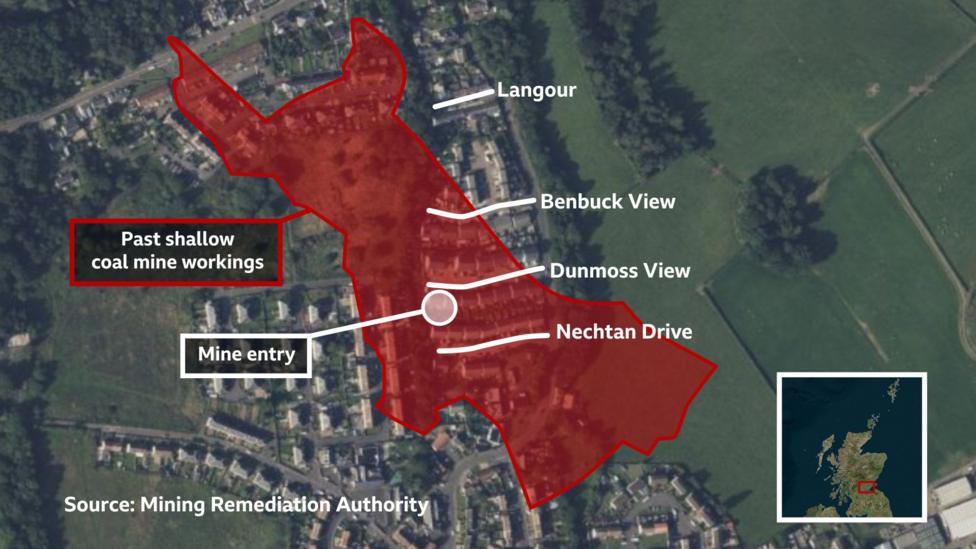
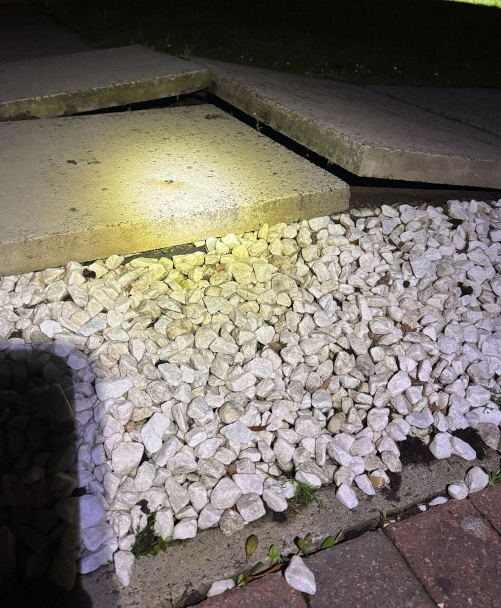
"A large area in the centre of the site has subsided by up to 0.6m (1.9ft). "The majority of Benbuck View properties and properties along the northern row of Dunmoss View are within the primary area of subsidence, although this does not rule out collateral impacts to properties beyond the subsidence area."

Which streets were evacuated?
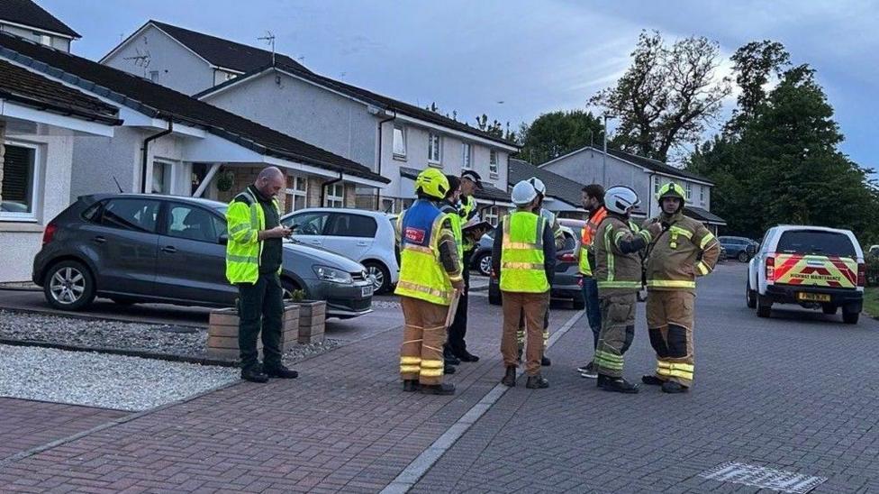
Benbuck View and Dunmoss View were the first two streets evacuated, followed by Nechtan Drive and Langour. Residents on Benbuck View were evacuated on 18 May after ground movement was reported at the site in May.
What did the report conclude?
The report concluded that
"on the balance of probabilities"the current evidence indicated that the
"most probable primary cause"is subsidence associated with historical coal mining.
It said:
"Multiple worked or potentially worked seams underlie the affected area at relatively shallow depth. "The 2008 grouting programme appears to have provided only partial ground treatment, with low grout takes, limited evidence of targeted shallow seam treatment, and uncertainty over whether deeper seams were investigated."
It said further study was required to better understand any secondary effects from coal mining subsidence at the site and future remedial works.
What happens next for residents?
Under the Coal Mining Subsidence Act 1991, the UK government has a duty to remedy coal mining subsidence damage. Households will find out the outcome for their property, and the specific options available to them, in the coming weeks and months.
This could include their homes being purchased at full market value. The affected residents are currently in short-term accommodation, including housing association properties, Airbnbs and student residences in Stirling.
What have residents said about the evacuation?
'We'll never return': What next for families evacuated from homes built on former mines?
Ground movement affecting village homes is linked to coal mining
Coalsnaughton residents: 'We were uprooted in an instant'
Key Facts
- An eight-week investigation by the Mining Remediation Authority linked the ground movement to historical coal mining beneath Coalsnaughton.
- A large area of the site has subsided by up to 0.6m (1.9ft) since 2018.
- 256 residents in four streets were moved out of their homes after movement was discovered in May.
- The report said the 2008 ground treatment appears to have provided only partial mitigation.
- Residents are in short-term accommodation while next steps are decided in the coming weeks and months.


