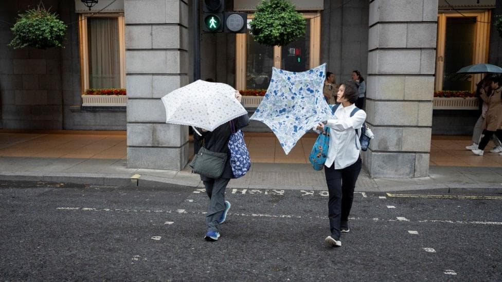
The UK faces a week of changeable autumn weather, beginning with warmth and sunshine on Monday before shifting to wetter and windier conditions as a strengthening jet stream ushers in deeper areas of low pressure. Temperatures will drop from above 20°C early in the week to closer to seasonal norms by Thursday, with the potential for minor disruption towards the weekend. Higher pressure is expected to build again towards the end of September, though the prospect of a late-month heatwave remains uncertain.
According to the Met Office week-ahead outlook, the UK will experience a succession of weather systems bringing rain and strong winds, interspersed with some drier and brighter intervals, particularly midweek. The period from 17 to 26 September is likely to remain changeable, with rain or showers most frequent in the north and west and strong winds possible at times.
How does the jet stream influence this week's weather?
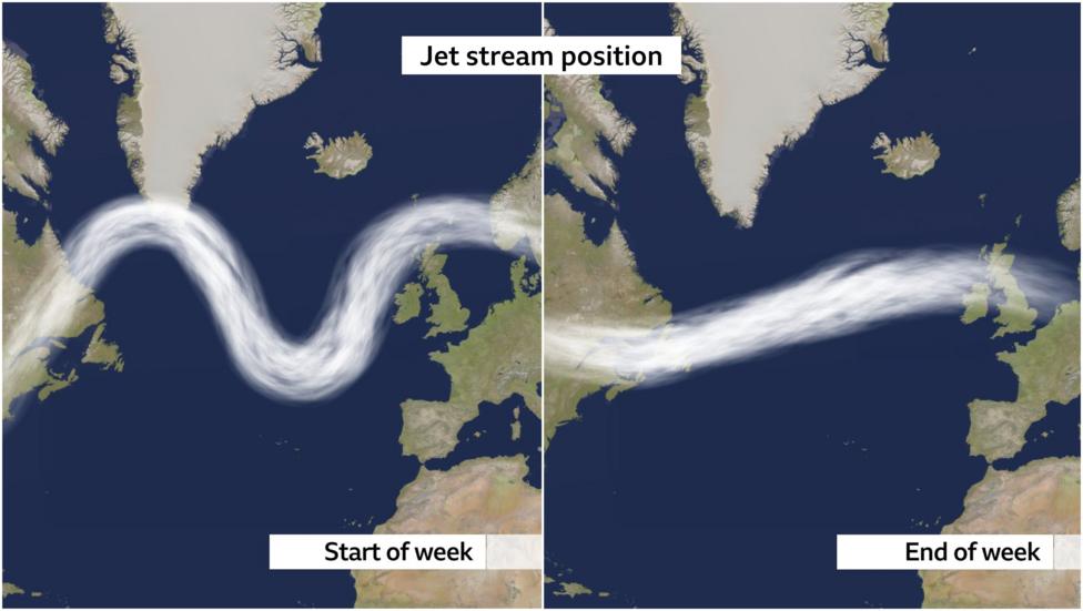
The jet stream is a ribbon of fast-moving air positioned approximately six miles above the Earth's surface, and its configuration, velocity and trajectory determine the type of weather experienced across regions below. Early in the week, the jet stream will be relatively weak and curve northward of the UK, permitting higher pressure to establish itself and allowing a warm south-westerly airflow to dominate. This pattern will reverse as the week progresses, with the jet stream adopting a more southerly trajectory and flowing faster and straighter towards British shores.
A flatter and stronger jet stream, with speeds exceeding 170mph, will transport deeper areas of low pressure to the UK as the week advances. This shift will result in lower pressure systems forming, bringing rainfall and gusty winds at intervals, alongside a noticeable temperature decline. According to Met Office guidance for the current week, gusts of 50–60mph are possible in northern and western Scotland.

What temperatures can we expect this week?
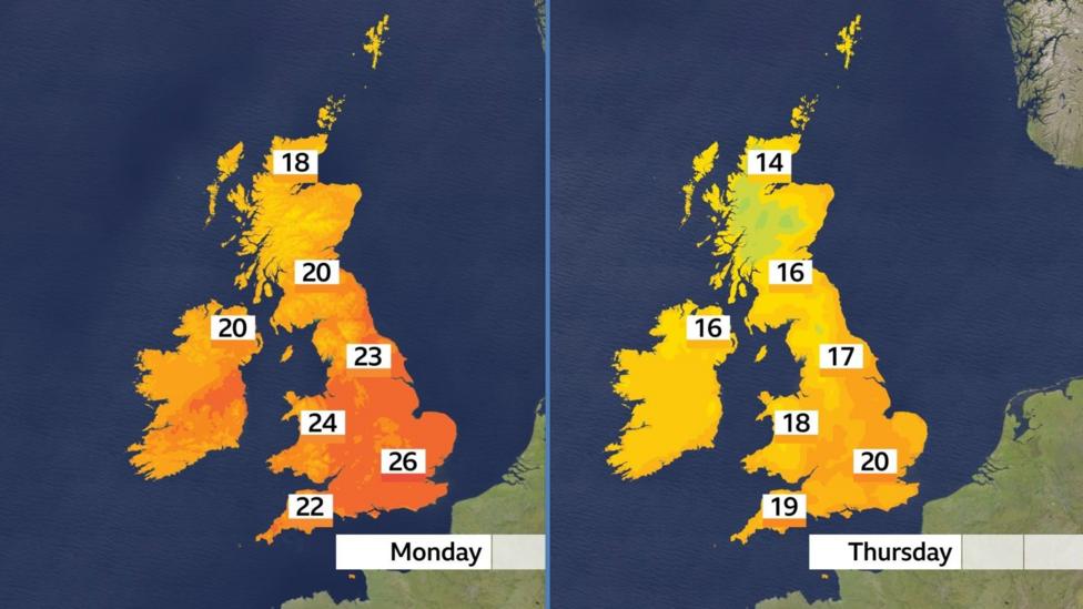
Monday will be the warmest day of the week, with air arriving from a south-westerly direction. Many areas will remain fairly cloudy, with some rain affecting coasts and hills in the west. Despite cloud cover, conditions will feel warm and rather humid, with temperatures climbing above 20°C across numerous locations. In central and southern England where sunshine breaks through, temperatures could reach as high as 26°C.
A shift in wind direction will bring a temperature decline throughout the week, with values settling closer to the seasonal average of 14–20°C. By Thursday, winds will turn more westerly or north-westerly, introducing a fresher air mass and a cooler feel. Temperatures by this stage will reach approximately 14 to 16°C in Scotland and Northern Ireland, and 17 to 20°C in England and Wales.
Could late September bring a heatwave?
Forecasts indicate that areas of high pressure should exert greater influence on weather patterns during the final week of September. This may result in longer dry interludes and the possibility of returning to above-average daytime temperatures, though the extent of any temperature rise will depend on how the high pressure system positions itself relative to the UK. According to the Met Office long-range forecast, temperatures for 17 to 26 September will probably remain close to average overall, with some rather warm days still possible and occasional grass frost on clearer nights.
Long-range forecasting carries inherent uncertainty and details remain subject to change, but current guidance contains nothing to suggest that a heatwave is developing. As autumn progresses and nights lengthen, high pressure overhead could instead lead to some rather chilly mornings. The next published long-range period, covering Sunday 27 September to Sunday 11 October, indicates that changeable weather with further rain, showers and strong winds will remain the most likely pattern.
Earlier Met Office analysis had already identified a northwest-to-southeast split in September's weather prospects, with wetter and more unsettled conditions more probable in the northwest and a better chance of drier weather in the southeast.
Key Facts
- Monday will be the warmest day of the week, with temperatures potentially reaching 26°C in central and southern England
- A strengthening jet stream with speeds exceeding 170mph will bring deeper low-pressure systems and stronger winds later in the week
- Wind gusts of 50–60mph are possible in northern and western Scotland
- Temperatures will drop to 14–16°C in Scotland and Northern Ireland by Thursday, and 17–20°C in England and Wales
- No heatwave is currently forecast for late September, though some warm days remain possible alongside occasional ground frosts