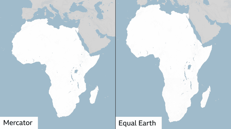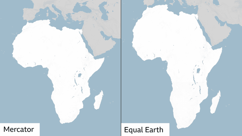
The United Nations General Assembly has adopted a resolution calling for the world's predominant map projection to be replaced with one that more accurately represents the true proportions of continents and countries. On September 4, 2026, the assembly passed the "Correct the Map" resolution with 164 votes in favor, 1 against, and 6 abstentions, endorsing the Equal Earth projection as an alternative to the Mercator map that has dominated global cartography for more than four centuries.
The resolution addresses a fundamental distortion in the Mercator projection: Africa appears roughly the same size as Greenland on the map, despite being approximately 14 times larger in reality. The resolution was sponsored by African states and framed as a response to perceptions that Africa is peripheral on world maps, with advocates arguing that distorted representations have psychological and economic consequences for how regions are perceived globally.
Kenyan geographer Kioko Muendo emphasized the broader implications of cartographic representation, stating that
maps are more than just guides for travellers - they shape how regions are perceived politically and economically. For Muendo and other critics, the Mercator projection's visual diminishment of Africa has implicitly downplayed the continent's vast resources, population and investment opportunities.
The History and Purpose of the Mercator Projection
The Mercator map was created in 1569 by Flemish cartographer Gerardus Mercator and was designed specifically to aid European sailors in ocean navigation. According to cartography Professor James Cheshire at University College London, Mercator's innovation solved a critical navigational problem:
He wanted a straight line to be drawn on a map to look like a straight line in reality if you followed a compass bearing. That was what it was intended to do, and that's what it does brilliantly well.
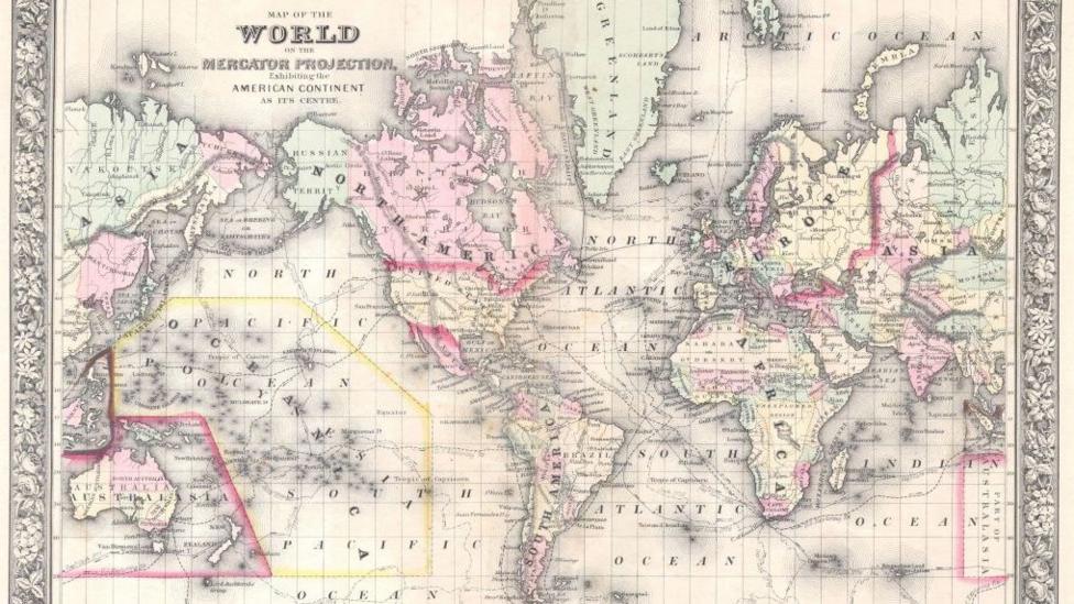
To maintain accurate compass bearings on a flat surface, Mercator stretched the grid lines progressively wider as they moved away from the equator toward the poles. This mathematical solution preserved the angles essential for navigation but created significant distortions in landmass size. Countries near the equator appear much smaller than they actually are, while those closer to the poles appear stretched and enlarged. More than 450 years after its creation, the Mercator projection remains the foundation for maps displayed in classrooms, on television, and online platforms including Google Maps.
The distortion inherent in the Mercator projection stems from a fundamental challenge in cartography: the impossibility of accurately representing the curved surface of a sphere on a two-dimensional plane without introducing some form of compromise. Every map projection must sacrifice at least one property—whether area, shape, distance, or direction—to render the globe on a flat surface.
What Is the Equal Earth Projection?
The Equal Earth map was developed by a team of cartographers in 2018 specifically to present the size and shape of landmasses more accurately than the Mercator projection. The projection was inspired by the 1963 Robinson projection, which displays the entire globe's surface at once while attempting to balance multiple cartographic properties.
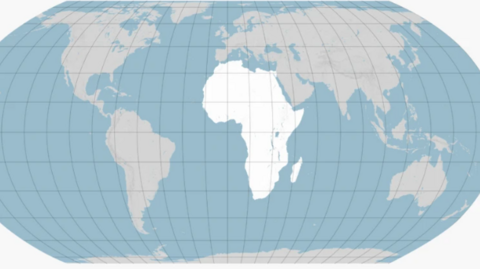
The Equal Earth projection is an equal-area map that provides a fairer representation of continental and national proportions. However, this improvement comes with its own trade-offs. The Equal Earth projection sacrifices the straight lines that made the Mercator projection ideal for navigation, and it cannot be used for measuring true distances between different locations. As Professor Cheshire explained,
You can preserve area, or you can preserve shape, or you can preserve distance and direction, but not everything at once perfectly, because otherwise you'd be back to a sphere.

The Equal Earth projection was adopted by African Union members in February 2026, preceding the UN General Assembly vote. The African Union's own assembly also adopted the Equal Earth projection in 2026, reinforcing the momentum behind the international campaign for cartographic reform.
Alternative Map Projections and Their Limitations
The Peters world map, designed by German historian Arno Peters in the early 1970s, represents another attempt to address the size distortion problem. Based on a projection first described by Scottish cartographer James Gall in 1855, the Peters map prioritizes accuracy of area over accuracy of shape. This approach successfully resolves the Greenland-Africa size discrepancy and allows viewers to grasp the comparative sizes of different landmasses while preserving straight lines of longitude and latitude.
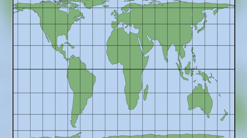
However, the Peters projection severely distorts the shapes of Earth's landmasses, causing them to appear slightly off. Russia, for example, appears considerably smaller in shape than it actually is. Additionally, the straight lines on the Peters map do not represent true constant compass bearings, rendering it useless for navigation purposes—a significant limitation for maritime and aerial applications.
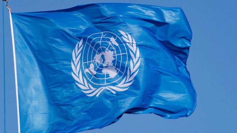
Other cartographic approaches exist as well. The azimuthal equidistant projection places world regions at proportionally correct distances from a single chosen centre point, with all points maintaining the correct azimuth, or horizontal direction, from that centre. The United Nations flag provides a well-known example of this projection type, with the world map centred on the North Pole.
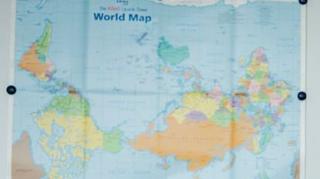
The south-up, or upside-down, map orientation represents yet another alternative approach. This projection simply rotates a traditional north-up map by 180 degrees, placing the world's southern regions on top and challenging conventional assumptions about geographical orientation.
International Response and Implementation Plans
The UN resolution's adoption was not unanimous. The United States opposed the resolution, stating it promoted an "ideological agenda" and distracted from "genuine problems of international peace, prosperity or good relations." The Togolese ministry, which championed the resolution, clarified that the measure does not challenge the Mercator projection's continued use for maritime and aerial navigation, where its directional accuracy remains valuable. The resolution itself is non-binding, meaning it does not mandate member states to adopt the Equal Earth projection but rather encourages its consideration and use.
Looking ahead, significant implementation efforts are planned. According to reports, Togo has scheduled a follow-up event in Lomé in the first quarter of 2027 in partnership with UNESCO, the African Union, and technology companies including Google Maps to discuss practical implementation strategies. The campaign has also requested that the UN geospatial body, UN-GGIM, review the proposal through its committee of experts, ensuring that technical considerations are thoroughly evaluated before widespread adoption occurs.
The Broader Significance of Cartographic Representation
The debate over world map projections extends beyond technical cartography into questions of global perception and power. For centuries, the Mercator projection has shaped how people understand the world's geography, with profound implications for how regions are valued economically and politically. The push to adopt the Equal Earth projection represents an effort to correct not just mathematical distortions but also the psychological and geopolitical consequences of those distortions. As the campaign moves forward, the challenge will be balancing the need for accurate area representation with the practical requirements of navigation and the entrenched habits of map users worldwide.