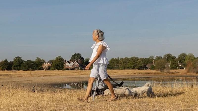
Some of the driest regions of the UK have missed their chances for rain ahead of another heatwave beginning this week. Parts of the northern and western UK saw some rainfall over the weekend, but southern areas - where the least amount of rain has fallen - are set to see temperatures climb again, with more dry and sunny weather in the forecast.
It comes as parts of Wales have officially entered drought status, while parts of southern, central and eastern England remain in "prolonged dry weather", the final stage before drought is declared. The coming days are expected to worsen dry conditions as another heatwave is set to be declared, with temperatures peaking around 35C (95F) in south-east England.
In advance of the high temperatures, heat health alerts have been issued by the UK Health Security Agency (UKHSA).
The south-west, south-east, London, East of England, West and East Midlands and Yorkshire and The Humber are all under the alerts from 9:00 BST on Tuesday 28 July until 9:00 BST on Friday 31 July.
The UKHSA warns that heat is expected to cause minor impacts for health and social care services, with an increased risk to life for vulnerable people.
Is there a hosepipe ban in my area? What you need to know
What is the definition of a heatwave?
How hot will it get this week?
The hot weather will initially be focused on central and eastern England by Tuesday before spreading slightly northwards and westwards into midweek.
Temperatures in England and Wales are forecast to rise to around 25-32C for much of next week.
However, Wednesday is likely to be the hottest day, with readings of 30-35C across the Midlands, southern and eastern England.
Wednesday is likely to be the hottest day

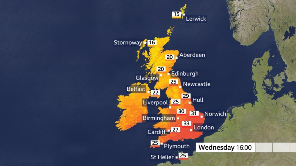
Scotland and Northern Ireland will generally remain cooler and showery with temperatures in the high teens or low to mid-twenties Celsius.
Current forecasts suggest that the intense heat across southern and central Britain this week will be short-lived compared with previous heatwaves this summer.
No substantial rain on the horizon for driest regions
Over the weekend, rainfall was focused mainly across the north and west of the UK.
Meanwhile, the driest locations - including central, southern and eastern England - saw little, if any, meaningful rainfall.
As the spell of hot weather develops across England and Wales, the lack of significant rain means dry ground and low soil moisture levels are likely to become an increasing concern.
The driest parts of England and Wales have seen exceptionally low rainfall so far this month.
Some areas, particularly in parts of north Wales and southern and eastern England, have recorded only a few millimetres of rain or even less.
Wisley in Surrey has been one of the driest locations in southeast England with 39 days of no rainfall as of 26 July.
In the driest spots, totals have been below 2% of the average July rainfall.
Second half of summer to bring chances for rain but heatwave threat persists
Parts of the UK move closer to drought