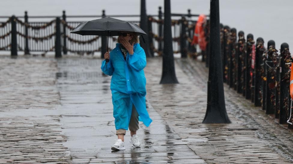
After weeks of record-breaking heat, the UK is finally experiencing a significant shift in weather patterns, with rain, thunderstorms and unsettled conditions dominating the bank holiday weekend. The change arrives as millions of people prepare to travel, with the RAC estimating that 20 million leisure trips by car will be made between Friday and Monday—the highest figure since the organisation began tracking summer bank holiday travel in 2015.
Persistent wet weather will characterise the next several days, featuring showers, extended periods of rain and frequent thunderstorms. By Monday, the heaviest rainfall is expected to concentrate across Scotland, while other regions will see brighter intervals emerging between the downpours.
This unsettled pattern is being driven by another area of low pressure approaching from the Atlantic, which will bring successive bands of rain and showers as the weekend progresses. The shift represents a stark contrast to the warm, dry conditions that have dominated much of the summer.
What will Friday's weather bring?
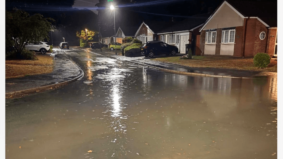
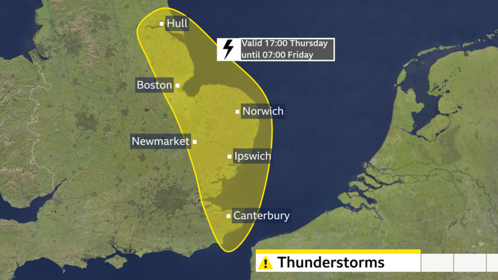
Friday will see the most severe weather, with a yellow weather warning for thunderstorms remaining in place across eastern England until 07:00 BST. Residents in this zone face the risk of frequent lightning, hail and strong, gusty winds alongside heavy rainfall. The Met Office warned that some places could experience 20–30 mm of rain in an hour locally, 30–40 mm more widely, and up to 50 mm in 12 hours in certain locations.
Across the rest of the country, showers and longer spells of rain will dominate, with heavy downpours and thunderstorms particularly likely over western Scotland, Wales and north-west England. Later in the day, this wet weather is expected to spread eastward, bringing thunderstorm risks to north-east England and eastern Scotland. Another band of thundery rain could move north across or close to parts of south-east and east England overnight.
Temperatures will feel noticeably fresher than recent weeks, with highs of 20–23°C (68–73°F) in England and Wales, and 16–20°C (61–68°F) in Scotland and Northern Ireland—figures that are around average for late August.

How will the weather develop over the weekend?
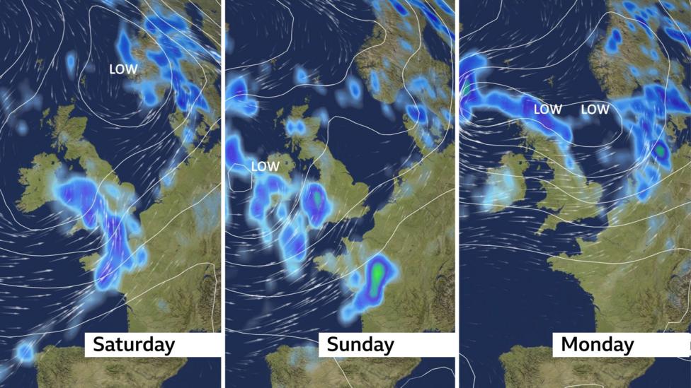
Saturday will remain changeable, with sunny spells interspersed with heavy showers and possible thunderstorms, particularly across England and Wales. Fresh westerly winds will create blustery conditions, with temperatures reaching 18–22°C (64–72°F) in England and Wales and 16–19°C (61–66°F) further north.
Sunday and Bank Holiday Monday will continue to be unsettled for England and Wales, bringing further heavy showers, longer periods of rain and renewed thunderstorm risks. According to reports on 27 August, Sunday and Monday are expected to bring a mix of sunshine and showers, with further rain moving in on Saturday and heavy downpours and possible gales over the weekend. Monday is forecast to be wettest across Scotland, while England and Wales will experience a mixture of sunshine and showers before additional rain arrives from the west. Stronger winds are also possible across southern areas, with temperatures generally ranging from 16°C to 23°C (61–73°F).
What does this mean for summer's record-breaking heat?
The late August bank holiday weekend will be substantially cooler, windier and wetter than the hot and dry conditions experienced throughout much of this record-breaking summer. While some pleasant sunny spells will occur between showers, with temperatures potentially reaching the low 20s in the south-east, the overall pattern marks a decisive end to the extended warm period.
With low pressure remaining positioned close to the UK, there is currently little indication of a return to prolonged hot and settled weather. The outlook for early September suggests further changeable conditions will persist, featuring a mixture of sunshine and showers with temperatures generally close to or slightly below average for the time of year.
The recent hot weather had drawn many visitors to beaches across the UK, but the approaching system will provide relief from the sustained heat that has characterised the summer months.

What should travellers expect?
The challenging driving conditions forecast for the bank holiday weekend present significant considerations for the millions planning to travel. The RAC's projection of 20 million leisure trips represents unprecedented demand for summer bank holiday journeys, and drivers should prepare for wet roads, reduced visibility from heavy rain and thunderstorms, and potential disruption from lightning and hail.
Met Office meteorologist Annie Shuttleworth indicated that the unsettled conditions were likely to persist for much of the bank holiday, suggesting that travellers should allow extra time for journeys and remain alert to changing conditions.
Key Facts
- A yellow weather warning for thunderstorms in eastern England expires at 07:00 BST on Friday, with risks of lightning, hail and strong winds
- The RAC estimates 20 million leisure car trips will occur over the bank holiday weekend, the highest figure since 2015
- Some locations could receive up to 50 mm of rain in 12 hours, with 20–30 mm possible in a single hour
- Temperatures will range from 16–23°C across the UK, significantly cooler than recent weeks
- Unsettled conditions are expected to continue into early September, with no prolonged return to hot weather currently forecast