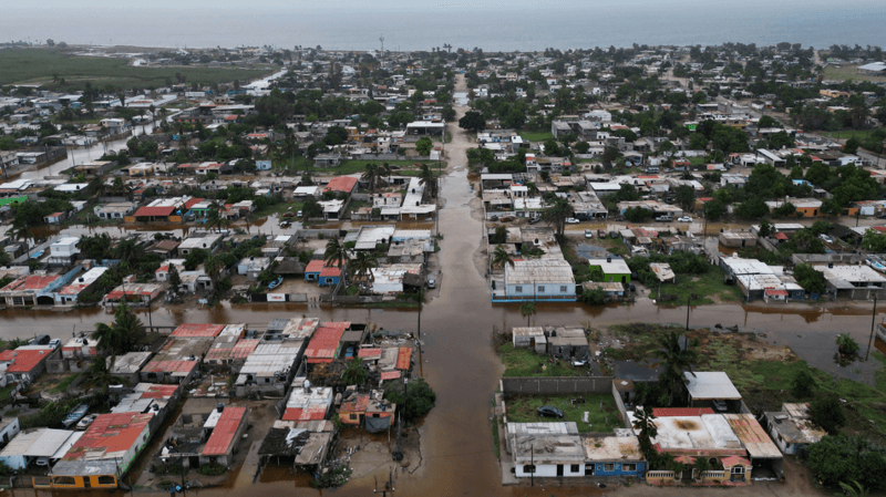
Flooded streets following the arrival of Hurricane Polo in the town of Puerto San Carlos, Baja California Sur, Mexico, on 29 September illustrated the intensifying impacts of a strengthening El Niño. The Category 3 storm arrived during an exceptionally active hurricane season turbocharged by the warming Pacific pattern.
The El Niño phenomenon has continued to intensify to levels that some scientists describe as "unprecedented," occurring weeks ahead of its anticipated peak in December. Multiple key measurements have now entered record territory, with forecasters warning of exceptional conditions extending well into 2027.
What are the current temperature records?
Ocean temperatures in the central Pacific have reached their highest levels ever documented. Australia's Bureau of Meteorology reported in its latest assessment that average weekly sea-surface temperatures in the central Pacific have surpassed all previous records. This follows a declaration by scientists of a new record for daily sea surface temperatures in the central-eastern Pacific during September, exceeding the previous benchmark established during the exceptionally strong El Niño of 2015.
The tropical Pacific has experienced temperatures above 30°C for the first time on record in certain areas, while record sea-surface temperature anomalies and exceptional subsurface warmth have been documented. These measurements derive from the equatorial Pacific region used to track El Niño development.
According to Copernicus climate monitoring, September's global-average sea-surface temperature reached 21.05°C, surpassing the previous September record of 20.92°C recorded in 2023. The same source measured the Niño3.4 index—a key indicator of El Niño strength—at 29.70°C in September, though its director noted it remained too early to definitively confirm whether this represents the strongest El Niño on record.
How does this compare to previous El Niño events?
El Niño is a naturally-occurring climate pattern that typically emerges approximately every two to seven years and generally persists for around one year. However, the Pacific Ocean is simultaneously warming due to human-induced climate change, which is beginning to obscure the strength of the natural warming signal during El Niño events.
To isolate the natural El Niño warming from the broader climate change signal, Australian and United States official forecasters now employ a Relative Ocean El Niño Index (RONI), enabling more accurate comparison to historical events. Using this adjusted measure, the Bureau of Meteorology's average weekly data—while only extending back to 2008—demonstrates significance by now exceeding levels observed during the record-breaking December of 2015.
"We are currently witnessing an El Niño event that is unprecedented in the historical record,"stated Dr Zeke Hausfather, a climate scientist at Berkeley Earth.
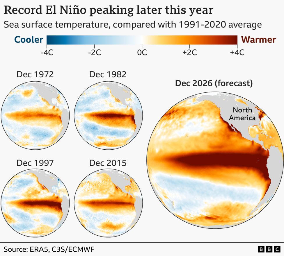
Comparisons with previous major El Niño events in 1972-73, 1982-83, 1997-98 and 2015-16 reveal substantially more widespread ocean warmth across the Pacific and extending into the Gulf of Mexico. Part of this broader warmth reflects the long-term warming of the oceans, but scientists emphasize this does not account for the entire phenomenon.
"The strength of El Niño this year is spilling out of the traditional El Niño region,"Dr Hausfather explained.
Is climate change making El Niño stronger?
The World Meteorological Organization currently reports no evidence that climate change is making El Niño events stronger or more frequent, though this remains an active area of scientific investigation. What is increasingly clear is that El Niño releases additional heat from the oceans into the atmosphere.
Historically, global temperatures during El Niño years have typically exceeded those during neutral years. When combined with human-driven climate change, that additional oceanic heat is projected to help make 2026 one of the warmest years on record, with unusually elevated global temperatures expected to persist into 2027.
What impacts are already being observed?
Although the most significant impacts are anticipated later in 2026 and into 2027, El Niño's influence is already manifesting across portions of the world. The strength of an El Niño does not automatically determine the magnitude of impacts in any particular location, as regional effects can vary substantially from one event to another.
However, recognizable patterns are emerging when compared with previous super El Niño events. During the 1997-98 episode, severe drought across south-east Asia contributed to extensive peat and forest fires, while parts of East Africa experienced catastrophic floods.
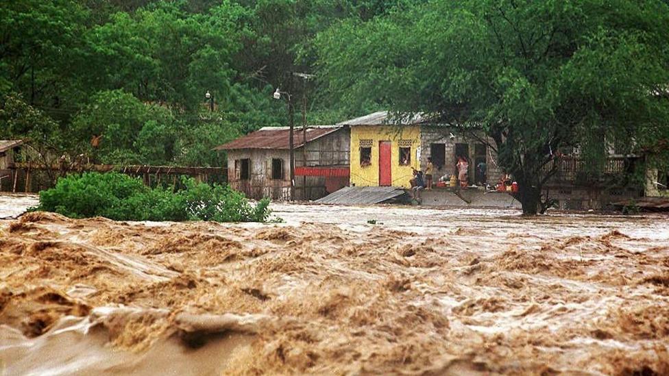
That event also contributed to making 1998 the warmest year on record at that time. A comparable pattern developed during the 2015-16 El Niño, when severe drought and wildfire activity returned to parts of south-east Asia, while southern Africa endured one of its worst droughts in decades, triggering a significant humanitarian crisis.
Another consistent signal involves tropical cyclone activity. Strong El Niño events typically suppress Atlantic hurricanes while enhancing activity across portions of the Pacific—a pattern that has also been evident during 2026. The World Meteorological Organisation indicates that drought and flood-related disruption is already being documented in several regions, with mounting concerns regarding food security in parts of East Africa and the Asia-Pacific.
How strong could this El Niño become?
According to NOAA's 8 October advisory, El Niño continues to strengthen, with a strong-to-very-strong event likely through January–March 2027. The agency assigns an 83% chance of a historic event for October–December, defining a historic event as a three-month relative Niño3.4 anomaly of at least +2.5°C.
The Bureau of Meteorology's weekly relative Niño3.4 index reached +2.81°C for the week ending 11 October, with its models projecting a peak monthly value exceeding +3.0°C. Dr Hausfather characterized the latest projections as "astonishing" and indicated they are likely to establish new records "by a remarkable amount."
What happens next?
Forecasts from both the European Centre for Medium Range Weather Forecasts and the United States National Oceanic and Atmospheric Administration indicate El Niño is likely to reach its peak in December. The Bureau of Meteorology's models forecast the Pacific warmth to peak around November or December and persist into autumn 2027.
NOAA's outlook expects El Niño to continue strengthening through year-end, with strong-to-very-strong conditions likely through the first quarter of 2027, extending the period of elevated global temperatures and associated regional climate impacts well beyond the traditional peak season.