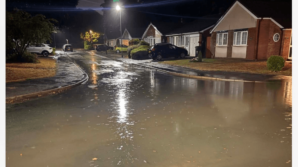
Overnight downpours have caused significant flooding across parts of Birmingham and Staffordshire, prompting emergency response from fire crews and triggering multiple flood warnings and alerts from the Environment Agency.
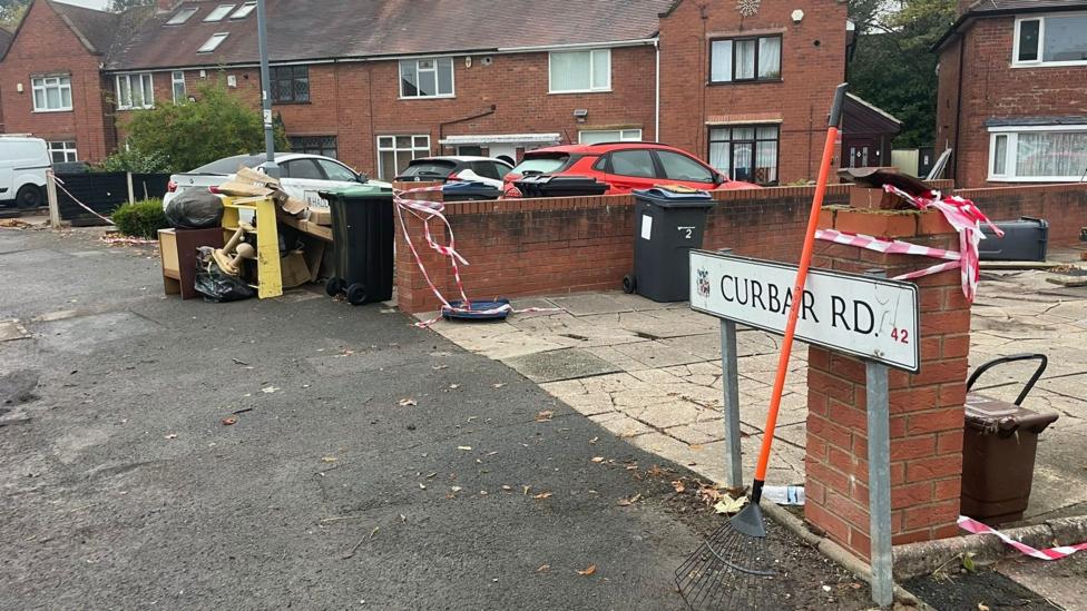
The Environment Agency issued a flood warning for Birmingham on Wednesday night after heavy rainfall swept through the region. Fire crews were called to deal with what they described as "significant flooding" in Perry Barr, with affected streets including Curbar Road, Thornbridge Avenue and Haddon Road. According to reports from the scene, West Midlands Fire Service deployed six crews to the Perry Barr flooding incident, working alongside Birmingham City Council and police to manage the emergency response. Residents were advised to avoid the area entirely.
In south Staffordshire, a lower-level flood alert was issued, with parts of Chasetown in Burntwood experiencing water ingress. That alert remained in place on Thursday morning. Sue Woodhouse, a resident of Chasetown, described the flooding on Saint Annes Close as
"the worst we've seen it in the last seven years of living here", highlighting the severity of the event for long-term residents.
A yellow thunderstorm warning covered England until 22:00 BST on Thursday, 27 August 2026, with Birmingham experiencing heavy downpours just before 08:00. Although the Environment Agency subsequently removed its flood warning for Birmingham, officials cautioned that standing water and debris could remain hazardous for some time. Birmingham City Council urged people to take care and avoid walking, cycling or driving through flood water.

Which other areas are affected?
The flooding extended well beyond Birmingham and Burntwood. Multiple parts of the West Midlands faced flood alerts on Thursday morning, with the Black Country, Warwickshire, Worcestershire and Shropshire all designated as areas of potential risk. According to the Environment Agency's live flooding page, 22 flood alerts were in force across the Midlands and South East on 27 August 2026.
Specific watercourses under alert included the River Blythe in Warwickshire, the River Stour and Smestow Brook in the Black Country and south Staffordshire, and the River Cole and Rea, though the Environment Agency was unable to provide precise details about specific risk locations for these latter two rivers. The Upper Tame at Sandwell Valley also featured on the alert list.
In Worcestershire, flooding was expected to affect low-lying land and roads adjacent to the River Salwarpe between Catshill and Hawford. Other at-risk locations in the county included Stoke Prior, Elmley Lovett, Droitwich Spa and Ombersley. Shropshire saw Stoke Heath added to the list of areas requiring monitoring.
What is the current weather situation?
The yellow thunderstorm warning remained active until 22:00 BST on Thursday, 27 August 2026, with further heavy rain expected across parts of England. The Environment Agency continued to monitor river and rainfall levels throughout the morning, with live level readings being updated for major watercourses including the River Trent and River Tame.
Key Facts
- Fire crews responded to significant flooding in Perry Barr, Birmingham, with six crews deployed to the scene supported by council and police
- The Environment Agency issued flood warnings for Birmingham and lower-level alerts for Burntwood and multiple other West Midlands locations
- A yellow thunderstorm warning covered England until 22:00 BST on Thursday, 27 August 2026, with 22 flood alerts in force across the Midlands and South East
- Residents were advised to avoid flooded areas and not to walk, cycle or drive through standing water
- Standing water and debris posed ongoing hazards even after the initial flood warning was lifted