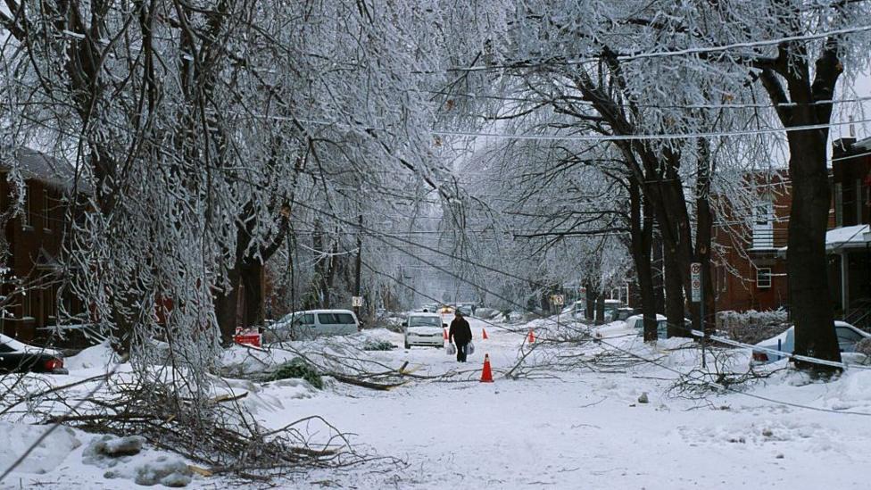
Montreal, Canada experienced devastating consequences during the Great Ice Storm of 1998, an event partly attributed to El Niño's influence on atmospheric conditions. Now, as a developing El Niño event—already among the strongest recorded in modern history—continues to intensify, meteorologists warn that autumn and winter weather across North America could undergo significant shifts through the 2026-2027 season and beyond.
According to BBC News, the naturally-occurring climate phenomenon involves trade winds over the Pacific Ocean, which typically blow from east to west, weakening or reversing direction. This allows warm water to spread eastwards, releasing heat into the atmosphere and driving major shifts in global weather patterns. The impacts across the US and Canada are complex and varied: northern regions face a greater likelihood of warm, dry conditions, while southern areas confront increased risk of flooding rainfall. Additionally, evidence suggests El Niño can heighten the probability of disruptions to the stratospheric polar vortex, potentially triggering snowfall later in the winter season.
It is crucial to understand that no two El Niños produce identical outcomes. The odds shift in favour of certain weather patterns, but impacts remain probabilistic rather than guaranteed. NOAA's November 12 outlook indicates El Niño is likely to strengthen before weakening in early 2027, with approximately a 60% chance of a historic event occurring during October–December and November–January.
Why southern regions expect wetter winters
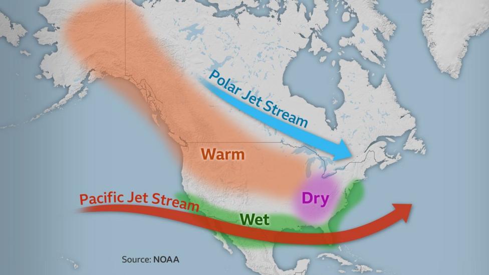
The eastward movement of warm ocean waters associated with El Niño typically causes the Pacific jet stream to shift southward and extend further east, directing moisture-laden weather systems across the southern United States. This pattern historically produces wetter winters during El Niño years. The US National Weather Service's latest three-month forecast suggests this outcome is probable for the 2026-2027 winter.
South-eastern states including Florida, Georgia, and the Carolinas face the greatest likelihood of experiencing above-average rainfall. NOAA's November outlook indicates that isolated parts of the Southeast have a 60–70% chance of above-normal precipitation, with some areas exceeding 70% in model guidance. The El Niño winter of 1997-1998 demonstrated the potential severity of these impacts, bringing significant flooding to the south-east and spawning tornadoes across Florida.
What threatens California's coast?
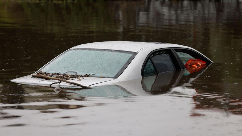
California faces substantial flood risk as forecasts suggest a wet winter is likely across the state. Governor Gavin Newsom has already declared a state of emergency in anticipation of floods and mudslides. Areas scarred by recent wildfires are particularly vulnerable, with climate change amplifying these hazards. However, El Niño's effects on California rainfall are not uniform: while many past events brought wet conditions—with the 2023-2024 winter providing drought relief—the strong El Niño of 2015-2016 actually delivered below-average precipitation.
Beyond rainfall, coastal erosion and large waves pose additional threats, potentially worsened by sea level rise driven by Kelvin waves. These occur when ocean water pushed eastwards across the Pacific by El Niño reaches the west coast of the Americas and can travel no further, creating a large-scale wave that spreads along the coast over weeks and months, raising sea levels by 15 centimetres (6 inches) or more. Climate scientist Daniel Swain noted that California's largest El Niño effects may not arrive until December or January, after the event peaks.
How will northern regions fare?
The southward shift of the Pacific jet stream generally produces warmer and milder winters across the north-west USA, Northern Plains, Ohio Valley, and western and central Canada. While this reduces flooding risk, diminished rainfall can leave groundwater and river levels depleted, potentially fuelling drought and wildfires during spring and summer months. Ski resorts may also suffer from reduced snowfall. Long-range predictions favour a dry, warm winter as more likely than usual this year, though El Niño does not guarantee this outcome—the winters of 1982-1983 and 2015-2016 were wetter than normal in the north-west USA despite El Niño conditions.
Thunder Bay has a 96% probability of above-normal temperatures for November–January, according to Environment Canada's seasonal outlook. The Northern Plains and Upper Mississippi Valley show the highest confidence for above-normal temperatures, with 60–70% probability in NOAA forecasts.
What does this mean for snow?
In much of the northern USA and large areas of Canada, the greater likelihood of dry and warm weather reduces the probability of significant snowfall. Further south, however, above-average precipitation typically generates substantial snowfalls in the Californian mountains and southern Rockies—beneficial for water supplies. This precipitation can also increase the chance of snow at lower elevations in the southern and eastern USA, provided sufficient cold air is present.
The Washington DC region often receives above-normal snowfall during El Niño winters, though this pattern is not consistent. Snowfall brought the city to a standstill in February 2010, when the winter of 2009-2010 delivered record-breaking accumulations and widespread blizzards affected much of the US east coast in 2016. Conversely, some of Washington DC's least snowy winters have coincided with El Niño events, including 1972-1973 and 1997-1998, which brought only 0.1 inches (0.25 centimetres) of snow.
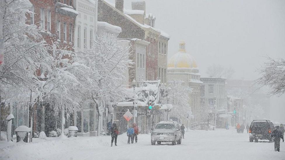
Higher winter temperatures in eastern Canada and the north-east USA can convert precipitation that would normally fall as snow into rain instead. This raises the likelihood of freezing rain events, with the Great Ice Storm of 1998 being partly blamed on El Niño's atmospheric effects. It bears noting that snowfall amounts are declining overall in most locations due to human-induced climate change, making predictions about El Niño's impact increasingly complex.
How might the polar vortex complicate forecasts?
An additional complication involves El Niño's potential influence on the polar vortex, a ring of powerful winds encircling the North Pole during winter at altitudes of 10 to 30 miles (16 to 48 kilometres) in the stratosphere. This vortex normally contains cold, dense air above the Arctic, but it can weaken and disrupt. Evidence suggests that the energy released into the atmosphere by El Niño increases the likelihood of such disruptions.
When the polar vortex weakens, the effects can ripple downward through the atmosphere, destabilizing the polar jet stream and allowing cold Arctic air to surge across Canada and the USA. However, these connections are not always reliable, and the mechanisms remain incompletely understood. The relationship between El Niño and polar vortex behaviour adds uncertainty to seasonal forecasts.
What happens next?
NOAA forecasts that strong-to-very-strong El Niño conditions have a greater-than-79% chance of persisting through January–March 2027. The event is expected to strengthen further before beginning to weaken in early 2027, meaning North American weather patterns will likely remain influenced by El Niño conditions through the winter and into early spring. Residents and emergency management officials across the continent should monitor updated forecasts as the season progresses, particularly in regions identified as facing elevated risks of flooding, drought, or severe winter weather.