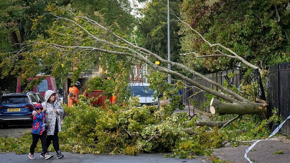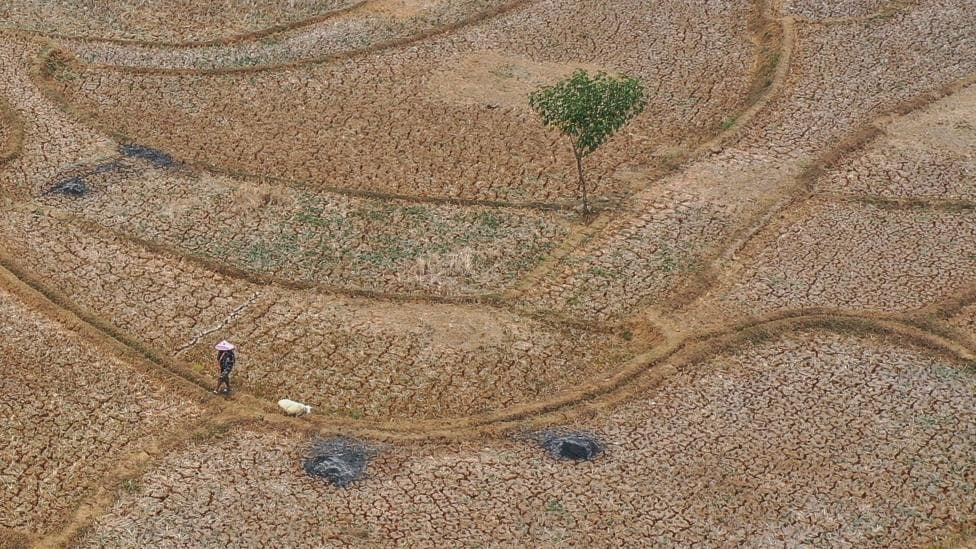
The strengthening El Niño phenomenon is reshaping weather patterns across the planet, triggering droughts, floods, and heatwaves in regions from Indonesia to the United States. According to BBC News, the World Meteorological Agency has warned that this record-breaking El Niño will intensify further and persist until at least 2027, with impacts already visible across multiple continents.
The phenomenon occurs when unusually warm ocean temperatures in the central and eastern Pacific alter atmospheric circulation patterns, creating conditions that amplify extreme weather globally. Countries including Indonesia, India and the United States have already begun experiencing the predicted consequences, with millions of people affected by wildfires, agricultural disruption, and unusual storm activity.
Indonesia Confronts Its Worst Wildfire Season in Nearly a Decade
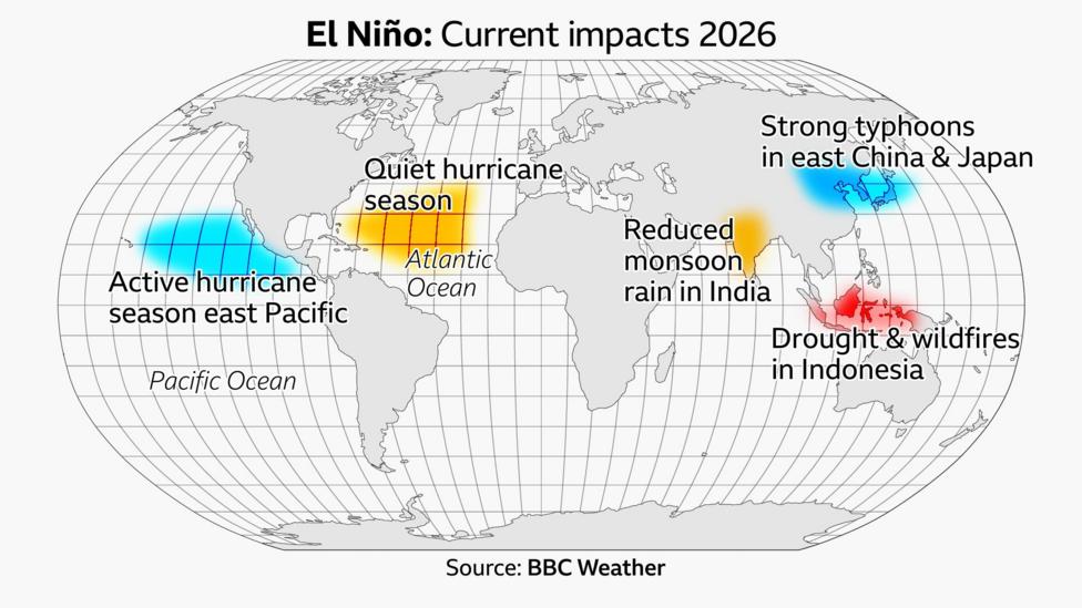
Indonesia, which typically becomes drier and hotter during El Niño years, is battling its most severe wildfire season since 2015. From January through October, the nation has recorded 1,061,746 wildfire hotspots, according to Down to Earth, exceeding the 885,037 hotspots recorded during the severe 2019 season. This represents a dramatic escalation from earlier in the year, when at least 895,657 hectares of land—nearly six times the size of Greater London—had burned by January alone.
The scale of destruction has forced widespread school closures and overwhelmed hospitals across the archipelago. Millions of residents in Sumatra and Kalimantan have been exposed to toxic haze, with approximately 175,000 people suffering from respiratory illness. More than 40,000 cases—ranging from coughs to bronchitis and pneumonia—have involved toddlers, highlighting the health crisis affecting the most vulnerable populations.
In October, wildfires destroyed nearly 300 homes on Sumatra and forced almost 1,000 residents to evacuate, according to The News. Indonesia's chief security minister, Djamari Chaniago, stated that authorities were "on alert" because weather conditions could allow the fires to grow further. Environmental groups and officials have also identified land clearing for plantations, mines and agriculture as major contributors to fire spread alongside the El Niño-driven drought conditions.
How Is the Eastern Pacific Hurricane Season Becoming Exceptionally Active?
The eastern Pacific basin is experiencing an unusually intense hurricane season, with El Niño providing the atmospheric ingredients that fuel storm intensification. Higher ocean temperatures and weaker winds high in the atmosphere create ideal conditions for tropical cyclones to rapidly gain strength before making landfall.
By mid-October, the region had generated 19 named storms, nine hurricanes and seven major hurricanes, according to the National Hurricane Center, with additional storms Simon and Trudy forming in October. This activity already exceeds the typical output of an entire average season, with the year still ongoing.
Hurricane Polo exemplified the season's intensity, experiencing rapid intensification that produced wind gusts of 180 mph (285 kmh), fueled by the exceptionally warm waters generated by El Niño. Polo was one of three hurricanes churning simultaneously in the same basin, alongside Odalys and Nolo. This phenomenon has now occurred twice within a single month—earlier in September, three simultaneous hurricanes (Lowell, Karina and Marie) churned through the central and eastern Pacific. Until this year, the last occurrence of three Pacific hurricanes at the same time was in 2015.
Why Has the Atlantic Hurricane Season Remained Unusually Quiet?
In stark contrast to the eastern Pacific's frenzy, the Atlantic Ocean has remained eerily calm. El Niño increases wind shear in the north Atlantic, a factor that tears apart developing storms and limits their formation.
Only one hurricane—Isaias—made landfall in the Florida Panhandle and Alabama. Isaias set a record as the latest-forming hurricane in the satellite era (since the 1960s), arriving after the previous record of 11 September, which had been set in both 2002 and 2013. In an average season, the Atlantic would have produced 10 named storms, five hurricanes and two major hurricanes by this point in the year. Instead, only eight tropical storms have formed: Arthur, Bertha, Cristobal, Dolly, Edouard, Fay, Gonzalo and Hanna.
How Is Reduced Monsoon Rain Threatening Indian Agriculture?
The drier and warmer conditions characteristic of El Niño have taken hold across India, where essential monsoon rainfall has fallen 13% below average. Although the Indian Meteorological Department considers this within the "normal" range, the national average masks significant regional variation that threatens agricultural productivity.
Central India received approximately its normal expected rainfall, but the east and north-east experienced rainfall 26% below average, classified as "exceptional" drought conditions. Southern states recorded rainfall 24% below average. Even in regions where rainfall approached the average, precipitation did not fall continuously as typical during the monsoon season. Instead, the pattern alternated between prolonged dry spells and extreme rainfall events, adding stress and vulnerability to agricultural yields across the country.
Scientists note that India is influenced by multiple weather patterns affecting the monsoon, suggesting that El Niño may not have been the sole factor driving the rainfall deficit.
Why Are Typhoons Becoming More Intense in East China and Japan?
Further west in the Pacific, eastern China and Japan have experienced an unusually active typhoon season as storms including Maysak and Dujuan brought widespread floods and landslides. The Japanese Meteorological Agency recorded 10 tropical cyclones forming in the western Pacific Ocean—the highest number in a season since 1966.
During El Niño, the warmer Pacific alters wind patterns, causing cyclones to form farther east than usual, away from Japan and east China. However, this geographical shift means storms travel a greater distance and have more time to feed off the warmer waters, gaining energy to intensify into more powerful typhoons before striking land. Scientists anticipate that additional typhoons will develop before the season concludes, with potential for further impacts to Japan and east China.
What Happens Next as El Niño Peaks?
The World Meteorological Organization forecasts that El Niño will persist through February 2027 with near-100% likelihood, with the event expected to peak around December. The organization's October outlook projects the Niño 3.4 sea-surface temperature anomaly near +3.7°C, positioning this as potentially one of the strongest El Niño events since at least 1950.
Beyond Indonesia's immediate crisis, NASA has reported that fires have begun spreading in the Amazon rainforest, describing them as the next stage of an El Niño-related tropical fire pattern. NASA scientist Douglas Morton has documented a recurring tropical fire "cascade" in which drought and peat fires in Indonesia are followed by elevated fire activity in the central and eastern Amazon. NASA expects fires around Santarém and Manaus to continue until the rainy season arrives in December 2026 or January 2027, with another fire-risk wave anticipated farther north in November and December.