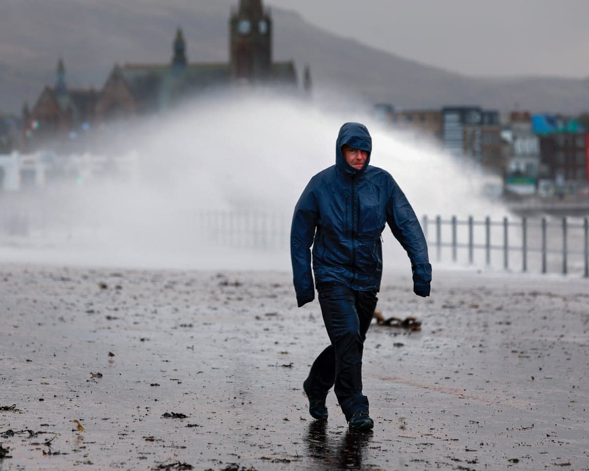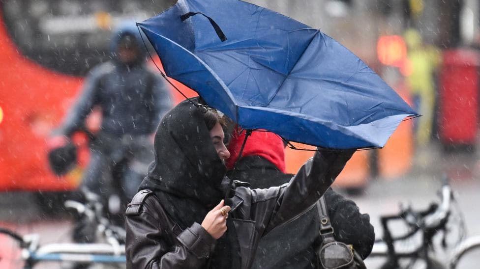
Following a weekend of torrential rain and violent winds from Storm Boelo, conditions across the UK are beginning to ease. However, the respite will be brief, as another significant area of low pressure is already tracking towards the country from the Atlantic Ocean.
According to BBC News, this incoming system will move across the north-west of the UK during Monday and Tuesday, delivering another round of heavy rain and strong winds. A Met Office yellow wind warning has been issued for much of Scotland, parts of northern England and Northern Ireland on Tuesday. Unlike Storm Boelo, which caused widespread disruption over the weekend, this latest weather system is expected to be less severe overall and has not yet been assigned a name from the 2026/2027 storm list—the next available name is Chloe.
During the previous storm, more than 1,500 flights were delayed and train services were disrupted, while Scotland's environmental watchdog issued 29 flood warnings and 11 flood alerts. The Met Office has cautioned that recent wet weather has heightened the risk of localised flooding as this new system approaches.
How will rain develop across the UK on Monday?
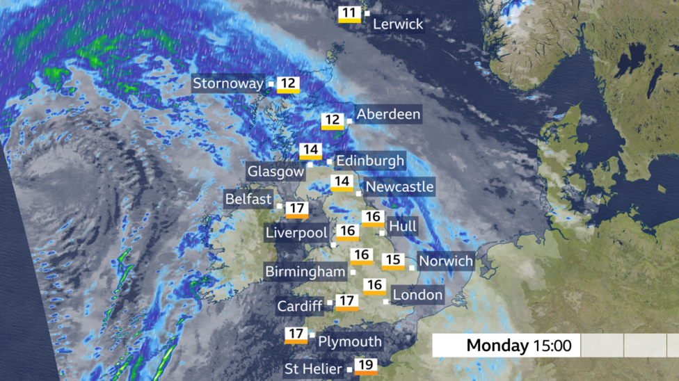
Rain will spread quickly northwards on Monday morning, initially affecting south-west England, Wales and Northern Ireland. This precipitation will advance rapidly north-eastwards, reaching central, eastern and northern England as well as most of Scotland by around midday. Some coastal and elevated areas will experience misty and murky conditions.
As the rain moves away, drier conditions will gradually extend across the UK from the south-west. Although cloud cover will remain extensive across many regions, isolated bright or sunny spells are possible, particularly in Wales and south-west England. Southerly winds will transport warmer air masses into the country, especially in the south where temperatures may reach 18 or 19°C. The most intense rainfall will affect Scotland by Monday afternoon.
When will winds strengthen and how severe will they be?
Monday will begin with breezy conditions, but winds will intensify significantly as the day progresses. Widespread gusts of 30-40mph are anticipated, with coastal areas experiencing gusts around 50mph. Conditions will deteriorate further overnight as the low-pressure centre passes near Northern Ireland and north-west Scotland, with peak wind speeds occurring on Tuesday.
The Met Office yellow warning encompasses almost all of Scotland except Shetland, extending into the north coast of Northern Ireland and the far north of northern England. The warning remains in effect from 03:00 until 23:59 GMT on Tuesday. Widespread gusts of 50-60mph are expected across the warning area, with the possibility of gusts exceeding 70mph in some exposed coastal locations. The Met Office forecast widespread gusts of 60–70mph in amber-warning areas, with gusts potentially reaching 80mph on exposed coasts.
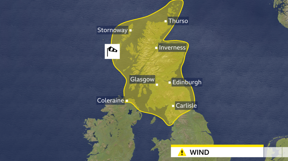
The Met Office warning indicates a low risk of significant impacts, though travel disruption, power cuts, structural damage to buildings and some flying debris remain possible. While this weather system is not anticipated to match the severity of Storm Boelo, its impacts could be amplified given how soon it follows the previous storm.
When will conditions improve?
High pressure will establish itself near the UK from midweek onwards, bringing a gradual improvement in weather conditions. Showers will persist on Wednesday, but most locations should turn dry by the end of that day. Thursday morning may see mist and fog develop under light winds, potentially causing some travel disruption in affected areas, though this should largely dissipate to reveal a dry day with sunny spells.
A weather front could introduce rain into western regions on Friday, but high pressure is then expected to reassert itself. Most computer weather models indicate that a drier and calmer spell is likely to develop over the weekend and into the following week, offering a more settled period after the recent succession of Atlantic storms.