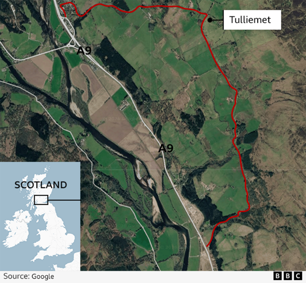
A technical malfunction in Google Maps caused significant disruption across Perthshire villages after the navigation system incorrectly directed drivers away from the A9 trunk road onto an unsuitable single-track route. The glitch, first identified on Friday, routed vehicles including campervans, coaches and cars with trailers through Ballinluig, Tulliemet and Guay via the unclassified U163 road between Dunkeld and Pitlochry.
Transport Scotland confirmed on Saturday via social media that Google Maps was falsely reporting the A9 as closed despite the road remaining fully operational, and was recommending what it termed an "inconvenient alternate route" to drivers. Although the mapping error has since been corrected, residents described the incident as dangerous and distressing, with some unable to leave their homes for several days.
What happened during the diversion?
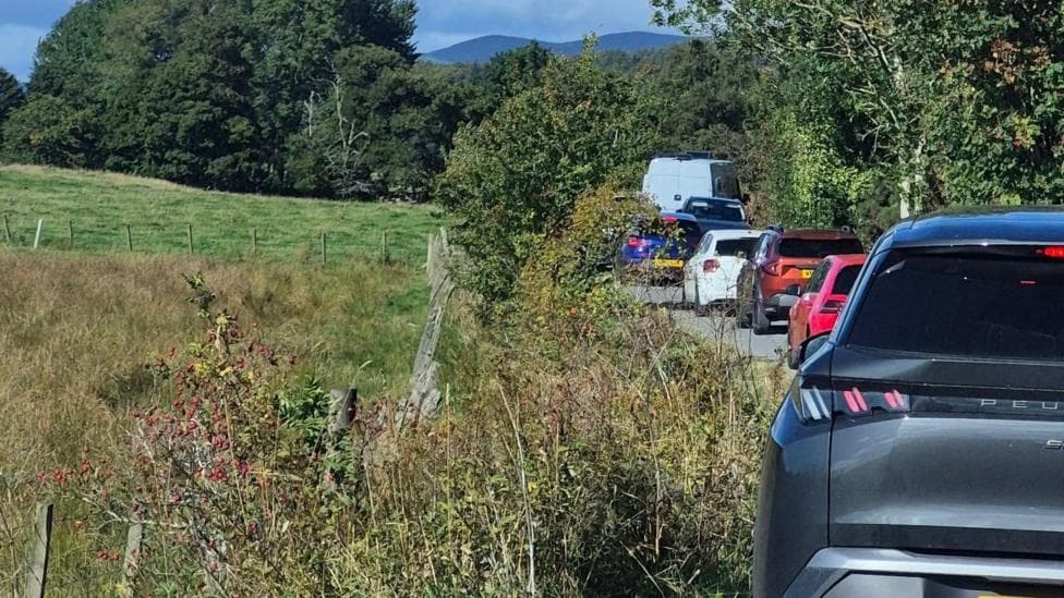
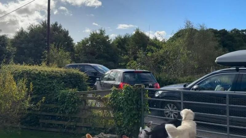
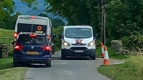
The narrow U163 road, which features no designated passing places and is lined with overgrown vegetation, became congested with heavy traffic moving in both directions. Joanne Boyne, a resident of Guay, witnessed vehicles travelling at speeds up to 40mph along the winding route—far too fast for its physical characteristics and width.
"People were just doing as Google said but the excessive speed was unbelievable,"Boyne told a national broadcaster.
"Traffic was going in both directions so when cars came to a section where nobody could pass, everyone had to reverse."
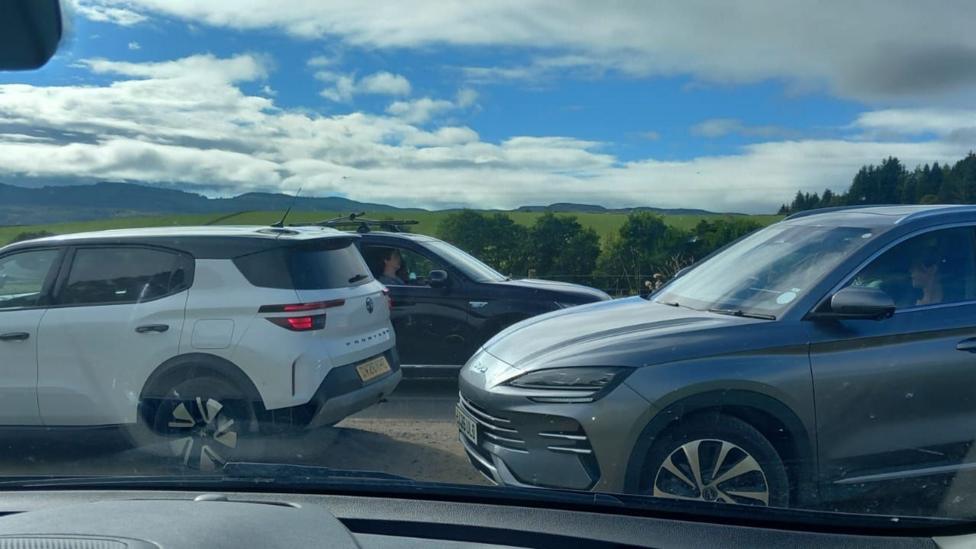
The volume and nature of traffic created gridlock conditions. Boyne observed campervans, a large coach and multiple cars towing trailers—including one towing a boat—navigating the unsuitable route. The bumper-to-bumper congestion raised serious safety concerns among locals, as emergency vehicles would have been unable to pass through had an incident occurred.
How did this affect local residents?
The disruption severely restricted residents' ability to move freely. Boyne's parents, who live approximately three miles away in Tulliemet, were unable to leave their house from Friday onwards, even for a walk, due to the dangerous traffic conditions. When Boyne attempted to visit them at the weekend, a journey that normally takes 10 minutes stretched to almost 45 minutes.
The impact extended into the working week. On Monday morning at approximately 07:50, Boyne struggled to reach her workplace, encountering three cars queued to turn onto the road from the A9—an unusual sight that indicated the problem had not fully resolved.
"We were really worried about trying to get to potential appointments or if there was an emergency,"she said.

How was the problem resolved?
Laura Hansler, representing the A9 Dual Action campaign group, explained that the mapping error was corrected after a member of the organisation contacted Google Maps' team in London. However, she noted that such glitches recur periodically without clear explanation. According to Google Maps Platform's status dashboard, a service update was recorded on 21 September 2026, though the available information does not confirm whether it directly addressed the Perthshire routing issue.
Hansler indicated that Google Maps has previously displayed inaccurate information on the A9, including incorrect speed limit data on sections of the trunk road.
"It is not an old diversion that was never cancelled, it is one of these daft diversions that make no sense,"she said.
"Sometimes it will tell you the road is closed because there has been a collision but sometimes Google Maps acts up for no reason."
Why do drivers rely on these systems?
Hansler explained that drivers using the A9 commonly depend on satellite navigation as a safety tool to avoid collisions and roadworks. When a diversion appears on such systems, most motorists automatically assume it reflects a genuine closure or hazard. This assumption proved problematic in this case, as many of the suggested alternate routes are unsuitable for large vehicles or high traffic volumes.
"People are using them proactively and on the A9 when someone sees a diversion, they automatically presume it is because something has happened,"Hansler noted.
"If these maps are not updated, it will cause an accident, which was my biggest fear at the weekend."
What is Transport Scotland's position?
When Hansler raised the issue with Transport Scotland and the Scottish government, she was informed that neither organisation maintains a direct relationship or data feed with satellite navigation providers such as Google. This means Transport Scotland cannot directly correct inaccurate routing information displayed by third-party mapping services, limiting its ability to prevent similar incidents.
The campaign group is now seeking further clarification and action from the government to address the underlying problem and prevent future occurrences. Google declined to provide comment on the incident.
What other traffic pressures exist on the A9?
The Perthshire diversion incident occurred against a backdrop of ongoing roadworks elsewhere on the A9. According to Traffic Scotland's active projects list, contraflow arrangements and 30mph speed restrictions were in place between Aberuthven and Crossgates on 21 September 2026, which may have added to route complexity for drivers in the region and potentially influenced navigation system recommendations.
An A9 resurfacing and drainage project between Aberuthven and Crossgates was scheduled to continue until 3 October 2026, while overnight resurfacing at the Pass of Drumochter was set to begin on 24 September 2026 and run until 2 October 2026, according to Traffic Scotland's roadworks schedule. These concurrent projects underscore the operational pressure on the A9 corridor during this period.
Key Facts
- Google Maps incorrectly reported the A9 as closed and directed traffic to the narrow U163 single-track road through three Perthshire villages
- The glitch, identified on Friday, resulted in campervans, coaches and large vehicles travelling at unsafe speeds on an unsuitable route with no passing places
- Some residents were unable to leave their homes for several days due to gridlock and safety concerns
- The error was corrected after the A9 Dual Action campaign group contacted Google Maps' London team
- Transport Scotland confirmed it has no direct feed to satellite navigation providers and cannot independently correct such routing errors