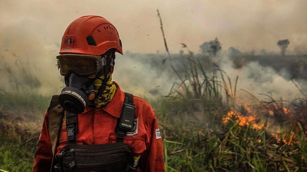
A thick blanket of noxious haze is engulfing Indonesia and drifting across borders into Malaysia, Singapore and the Philippines as weeks-long wildfires continue to burn across the region. Millions of people across Southeast Asia have inhaled smog so severe that in some locations it has reached "acutely unhealthy" pollution levels more than 15 times higher than the World Health Organization's recommended standards. The crisis is intensifying as a so-called Super El Niño exacerbates drought conditions, with September marking the peak month for the weather phenomenon and the most dangerous period for fire spread.
Wildfires have been raging across Sumatra and Indonesian Borneo since mid-July, driven by the combination of extreme drought and decades of land-use changes that have left landscapes vulnerable to burning. Between July and August, Indonesia's Health Ministry documented over 50,000 cases of respiratory infections linked to land and forest fires, with more than 12,000 of those affecting children under five years old. According to regional health reports, approximately 13,500 people were treated for respiratory infections during this period, and roughly 5.5 million people on Borneo and Sumatra faced direct exposure to smoke.
The haze has created hazardous conditions across multiple countries. In Malaysia's Borneo region, air quality reached hazardous levels, prompting the cancellation of outdoor Independence Day celebrations in some areas. According to ASEAN's regional alert system, the haze alert was raised to Level 3, indicating a high risk of severe transboundary haze as smoke persisted from multiple hotspots across the region.
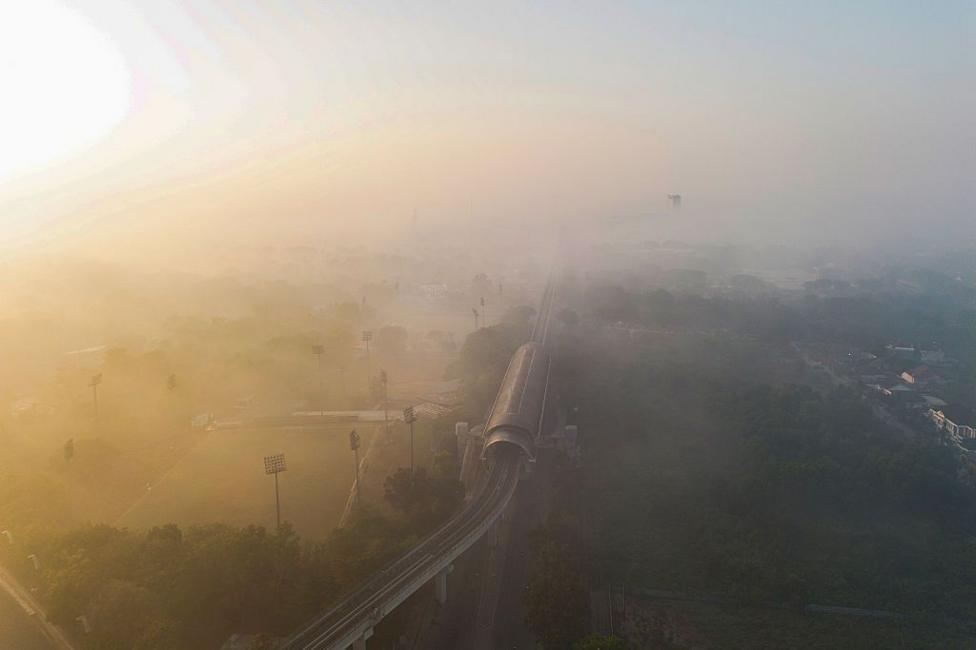
How is the haze affecting daily life?
The smog has become so thick in some areas that visibility has become severely compromised. Rizma Nur Fatimah, a 19-year-old teaching assistant at a school in Banjarbaru, South Kalimantan, described conditions in her classroom where the haze had become so dense that
"you couldn't even see your own feet."She added that
"Even inside the house, with everything closed, the haze still got in. We've been living with this since I was born. It's the same every year, so we've almost become resigned to it. But this year is worse."
Health impacts are being reported across the region. Misbah, a 23-year-old mother from Pengayuan village near Banjarbaru, reported that her three-year-old daughter developed
"a cough, a sore throat and a runny nose"during the haze period. Some 1,300 kilometres away in the Philippine island province of Palawan, residents described similar symptoms including itchy eyes, nose and throat irritation. Dr Precious Bañas-Melad, a resident of Palawan, reported that
"We are now experiencing mild headaches. My cousin who isn't allergic to anything started developing allergies. My husband is the first one who had itchy eyes and throat."
Malaysia has documented rising cases of asthma and conjunctivitis nationwide as air quality continues to deteriorate. According to air quality monitoring data, the haze pushed air quality to "very unhealthy" or "hazardous" levels across parts of Borneo and the Philippines.
Why are these fires so severe?
Indonesia's forest and peatland fires are not new, but their severity reflects decades of land-use transformation. During the Suharto era, vast areas of rainforest and peatland in Kalimantan were cleared for logging, plantations and large-scale development projects. Today, large-scale fires are frequently associated with the expansion of industrial plantations and commercial land use. Environmental groups, researchers and government investigations have repeatedly alleged that some companies deliberately use fire as a cheap and effective method to clear vast areas of land.
While drought and El Niño conditions help fires spread rapidly, the intensity of the haze is also directly linked to human activity. Drained peatlands, industrial timber estates and oil palm plantations create landscapes that are far more vulnerable to burning, with fires often recurring in the same areas year after year. Unlike traditional practices, which are small-scale, community-managed and closely monitored, fires linked to large-scale land development are far more difficult to control and generate environmental and public health impacts on a much larger scale.
According to Indonesia's forestry authorities, fires are currently burning across East and West Kalimantan, Riau, South Sumatra and Jambi provinces.

What makes peatland fires particularly dangerous?
Indonesian Borneo's wildfires are especially concerning because they are burning through one of the world's largest tropical peatland ecosystems. Under normal conditions, these peatlands function as gigantic carbon reservoirs. However, under the abnormal drought conditions currently affecting the region, they can transform into carbon "bombs."
Dr Nisa Novita, a peatland researcher at Indonesian conservation NGO Yayasan Konservasi Alam Nusantara, explained the mechanism:
"Peatlands are incredibly effective carbon stores because their waterlogged conditions slow decomposition, allowing carbon to accumulate underground for thousands of years. But this also means they can become a 'carbon bomb' when they are drained or burned, because that carbon can be rapidly released into the atmosphere."
The scale of potential carbon release is staggering. Last year, without El Niño conditions, forest fires in Indonesia burned a 359,000-hectare area. However, according to Professor Bambang Hero Saharjo, a forest fire forensics expert from Institut Pertanian Bogor University, this year's Super El Niño could burn an area as large as 11 million hectares – matching one of Indonesia's worst wildfire seasons, which occurred from 1997 to 1998.
How does this compare to previous haze crises?
The region's most severe comparable haze episode occurred in 2015, when fires in Indonesia exposed tens of millions of people to toxic smoke and caused more than 500,000 respiratory ailments across the region. The current crisis has the potential to rival or exceed that disaster if fires continue to intensify through September and into October.
Experts warned in June that below-normal rainfall could sustain fires and haze conditions through October, extending the period of public health risk across the region.
What is being done to combat the fires?
Indonesia's government has acknowledged the severity of the situation. Earlier this week, Indonesia's forestry minister Raja Juli Antoni told reporters that the battle to extinguish the current wildfires was entering a critical phase.
"Our problems are not over. September is the peak of El Niño,"he said.
"September is the main fight for us."
According to Indonesia's Forestry Ministry, the country is maximizing weather modification techniques, aerial water-bombing operations and ground task forces throughout September. Indonesia's disaster management agency reported that it was intensifying firefighting and haze control efforts across six provinces as September began and El Niño reached its peak intensity.
What happens next?
Forecasters have warned that haze impacts could persist for several weeks if emissions continue to increase through September into October. Air quality improvements are expected to be gradual, with some areas like Kuala Lumpur forecast to return to moderate levels within days, while other locations such as Kuching may take longer to see improvement.
The critical period for the region extends through September as El Niño peaks, making this month the most dangerous for fire spread and haze accumulation across Southeast Asia. The combination of peak drought conditions, peatland vulnerability and ongoing land-use pressures creates an unprecedented challenge for the region's governments and populations.
The crisis underscores the interconnected nature of climate, land management and public health across Southeast Asia. Without significant intervention, the fires could continue to worsen, exposing millions more people to hazardous air quality and releasing massive quantities of carbon into the atmosphere.