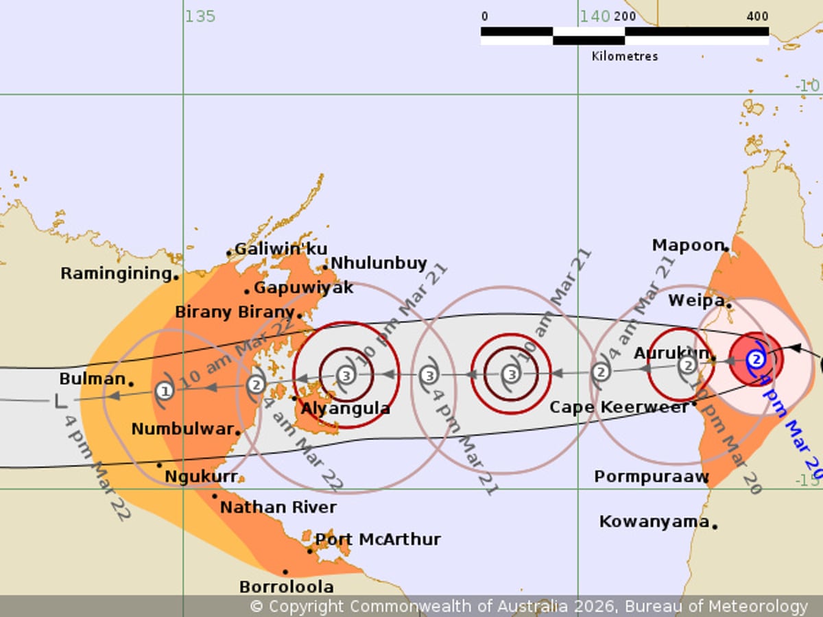
Second Landfall Expected in Northern Territory
Severe Tropical Cyclone Narelle weakened on Friday evening after making landfall in far north Queensland as one of the most intense cyclones recorded in the state’s recent history. The storm caused widespread damage including downed trees, roof destruction, and swollen rivers.
By 4pm local time, the Bureau of Meteorology downgraded Narelle from a category 3 to category 2 cyclone. Despite the downgrade, destructive winds near the centre remained at 100 km/h with gusts reaching up to 150 km/h.
The cyclone crossed the Cape York peninsula at 7am on Friday as a "high-end" category 4 storm, with sustained winds of 195 km/h, just 5 km/h below category 5 status.
Following the downgrade, the Bureau of Meteorology warned that the cyclone's centre was still producing destructive wind gusts of up to 150 km/h, expected to impact Aurukun in the western Cape region on Friday evening.
Damaging gales of up to 120 km/h were forecast between Weipa and Cape Keerweer as Narelle moved into the Gulf of Carpentaria on Friday evening. The system was anticipated to re-intensify over the water.
A second landfall was projected late Saturday night or early Sunday near the island of Anindilyakwa on the Top End’s east coast. The storm was expected to continue westward over already saturated areas around Katherine, south of Darwin, on Sunday.
Queensland Premier Comments on Impact
On Friday afternoon, Queensland Premier David Crisafulli reported that Narelle had moved westward, crossing the east coast between Lockhart River and Coen.
“It threaded a needle between both. While there’s some damage we’ve seen, and some rain and some wind, that’s an incredibly good news story,”
“It will be some time before we find out how widespread the destruction is,”
Climate experts have attributed the storm's intensity to global heating, noting that elevated ocean temperatures contributed to Narelle’s strengthening as it approached the coast.
Preparations in the Northern Territory
Communities in the Northern Territory, which have experienced consecutive flooding events in recent months, were finalizing preparations for Narelle’s arrival over the weekend.
By Friday afternoon, Narelle had weakened to a severe category 3 system with destructive wind gusts up to 185 km/h. Authorities confirmed there had been no rescues by mid-afternoon Friday.

Local Impact and Conditions
Debbie Jackson, residing 50 km north of Coen, reported extensive damage as the cyclone made landfall.
“We’re losing roofs everywhere,”
“Lots of trees down. We have lost a few roofs. It’s not real great,”
She added that she and seven others were sheltering in a shipping container until the storm passed.
The cyclone initially tracked towards Coen, a town of approximately 320 residents, in the early hours of Friday but shifted slightly northward at landfall.
Authorities issued warnings about the combined threats of strong winds, heavy rainfall, flooding from already swollen river systems, and storm surge coinciding with high tide.
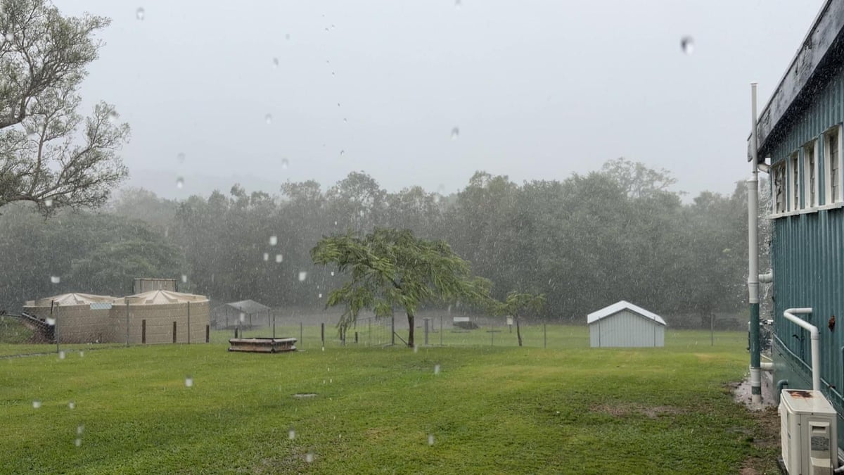
Residents of Coen described the town as unusually calm on Thursday, with heavy winds beginning around 4am Friday.
“You can hear a couple of things moving around outside now,”
“Until the wind started it was so still. It was raining but it was really still. That’s not like Coen, when it rains it pours and the wind moves about,”
Winds and heavy rain hit Coen as Cyclone Narelle made landfall.
Forecast and Climate Context
The Bureau of Meteorology predicted Narelle would weaken to a category 1 cyclone as it moved across the Top End through Sunday, with rainfall between 100mm and 200mm expected to cause renewed major flooding in areas including Katherine and Daly River.
Climate experts noted that the cyclone’s movement over the Coral Sea, where sea surface temperatures have reached record highs in recent months, provided additional energy to the system.
Higher ocean temperatures increase cyclone intensity, while rising sea levels exacerbate coastal inundation. Additionally, global heating contributes to increased rainfall production by such systems.
Emergency Warnings and Precautions
Emergency warnings have been issued for Lockhart River, Port Stewart, and Coen as authorities continue to monitor the situation.
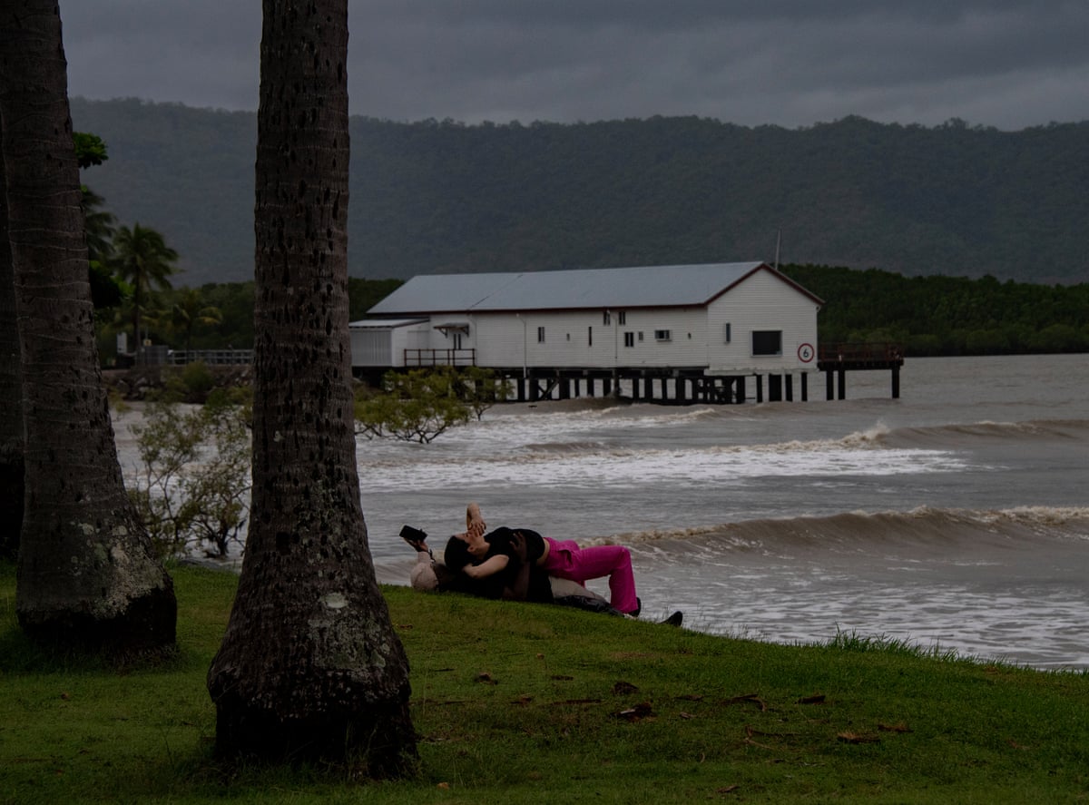
Storm clouds were observed in Port Douglas prior to the cyclone’s arrival.