Switzerland’s epic Jungfrau
Distance up to 74 milesDuration 3-9 days
The Bernese Oberland region arguably represents the Swiss Alps—and perhaps the entire Alpine range—at their finest. Here, the iconic peaks of the Jungfrau, Mönch, and Eiger stand together dramatically, while lakes display extraordinary colors, waterfalls cascade through enchanting valleys, and charming villages perch at impressive altitudes. Switzerland’s efficient network of PostBuses, gondolas, mountain railways, and extensive walking trails ensures excellent connectivity throughout the area.
Summer is the prime trekking season as trails are free of snow, mountain huts operate fully, and the weather tends to be stable. Numerous route options exist. According to Cicerone’s latest trekking guide, a recommended itinerary is a nine-stage, 74-mile moderate-grade hut-to-hut loop starting from Grindelwald, a picturesque mountain village.
For those with limited time, shorter walks are available between the car-free villages of Mürren and Wengen, Kleine Scheidegg (where the Jungfraubahn railway ascends to 3,454 meters), Grindelwald, and Schynige Platte. The hike to Schynige Platte, a mountain ridge offering views of snow-capped peaks and lakes Thun and Brienz, is considered one of Europe’s finest day walks.
How to do it Accommodation is widely available, and reservations for Swiss Alpine Club huts can be made in advance. An eight-day Grindelwald Trail trip is offered from £1,510 per person.
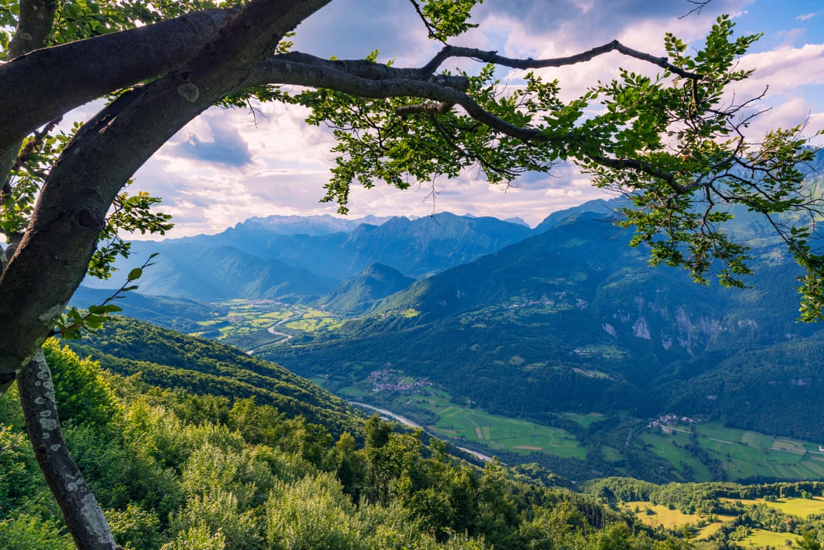
The Alpe Adria, the ultimate pleasure trail, Slovenia and Italy
Distance up to 465 milesDuration 7-9+ days
The Alpe Adria trail is a hiker’s dream for those with ample time, stretching over 450 miles from the base of Grossglockner, Austria’s highest peak, to the Adriatic Sea. For a shorter experience, a one-week segment in Slovenia’s Julian Alps offers spectacular scenery at a more affordable cost compared to Switzerland or France, with generally fewer summer visitors.
The route from Kranjska Gora to Cividale del Friuli in Italy traverses the high peaks and passes of Triglav National Park, the emerald Soča River, mountain villages, and historical sites from the Isonzo Front of World War I, where remnants such as old bunkers remain visible. This moderate-to-challenging 80-mile, six-day hike culminates with a remarkable final ascent over the Kolovrat mountain ridge, providing panoramic views of both Alpine peaks and the Adriatic Sea.
How to do it Details can be found online. An eight-day self-guided trip from Kranjska Gora to Cividale del Friuli is available from £1,095 per person.
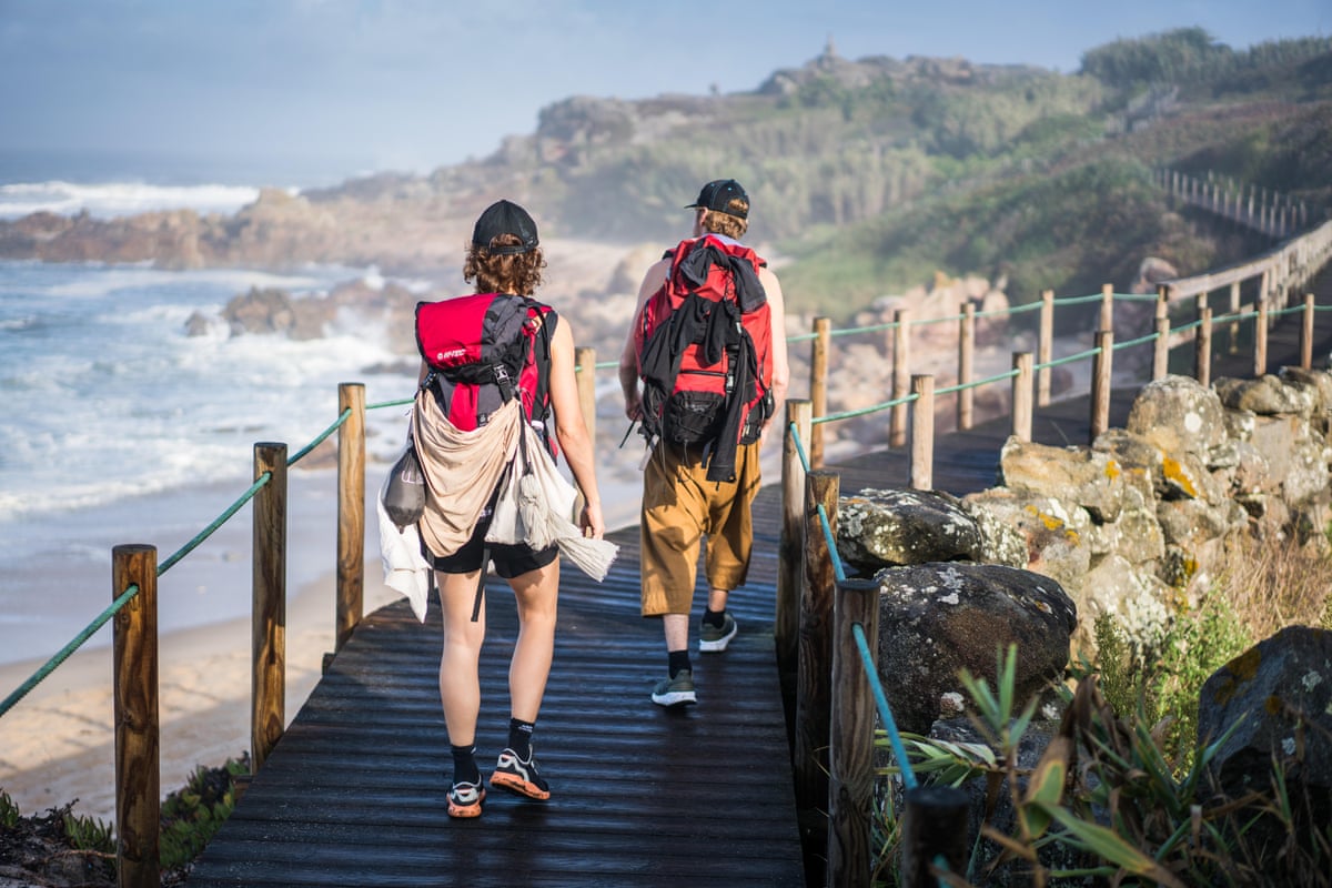
A coastal camino in Portugal and Spain
Distance 170 milesDuration 2 weeks
For those interested in a summer pilgrimage to Santiago de Compostela, the coastal route from Porto offers a less crowded alternative to the busier inland caminos. This third most popular camino provides ample opportunity for camaraderie among pilgrims and benefits from Atlantic breezes that moderate summer temperatures, along with frequent chances for refreshing swims.
The trail begins in Porto and follows the coastline through fishing villages and stretches of sandy beaches up to Caminha. From there, a boat crosses the River Minho, delivering walkers into Spain. The path continues hugging the coast to Vigo, the 100-kilometer point to Santiago, where many pilgrims start to qualify for the completion certificate. The final segment moves inland, passing the hot springs of Caldas de Reis and the pepper-producing town of Padrón before reaching Santiago.
How to do it Municipal pilgrims’ hostels operate on a first-come, first-served basis and cannot be pre-booked, while private hostels and hotels should be reserved in advance during summer. A 15-day self-guided Portuguese Coastal trip is offered from £1,839 per person.
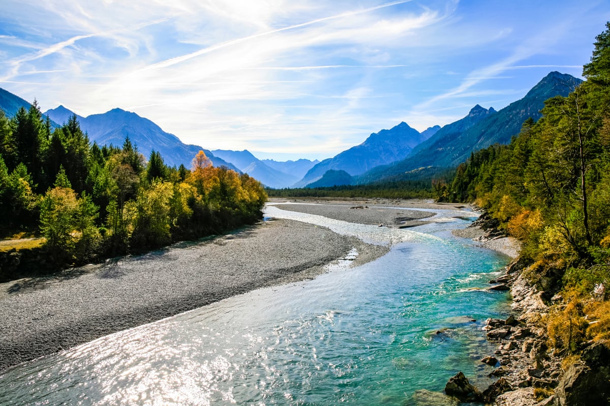
Along the Lech, an untamed Alpine river in Austria and Germany
Distance 78 milesDuration 7-10 days
Walking alongside water offers a refreshing experience, making the Lechweg trail an excellent choice for summer hiking. This easy-to-moderate route was the first to be designated a Leading Quality Trail by the European Hiking Federation, reflecting its superior infrastructure and clear waymarking.
The trail follows the River Lech from its mountain source near Austria’s Formarinsee lake at 1,793 meters—accessible fully only from mid-June to early October—to the Lechfall waterfall in Füssen, located in Germany’s Bavarian Alps. Upstream of Füssen, the river remains wild and free-flowing, with turquoise waters weaving over gravel beds, fed by Alpine streams, roaring through gorges, and frothing amid pine forests and towering peaks. Downstream, the river becomes tamer and is dammed for hydroelectric power.
Despite the seemingly untouched landscape, the trail passes through several mountain towns and villages offering comfortable accommodations, historic churches, and local artisans producing beer, cheese, and other goods.
How to do it Trail and accommodation information is available online. An eight-day self-guided Lechtal trip is offered from £990 per person.
The Beara Way, a quieter and wilder side of south-west Ireland
Distance up to 128 milesDuration 3-10 days
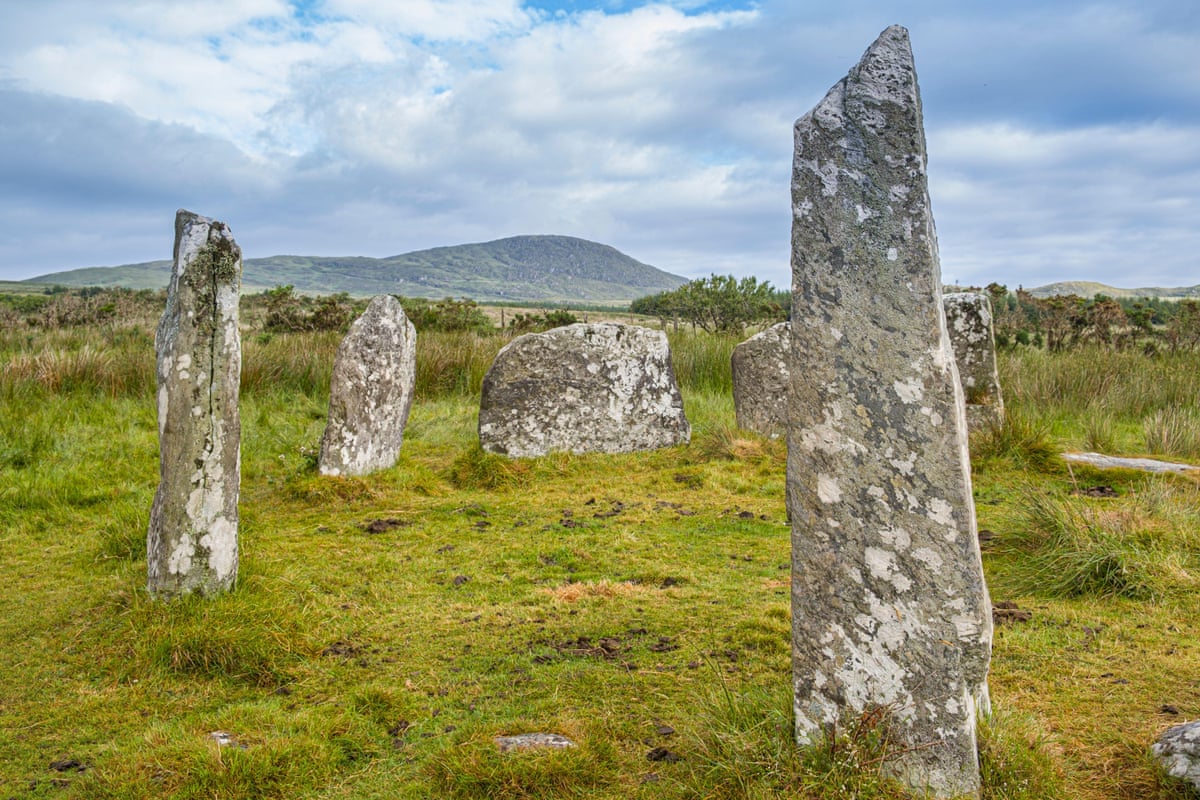
The Beara peninsula in south-west Ireland offers a cooler summer climate due to Atlantic breezes and is less frequented than the nearby Dingle and Iveragh peninsulas. The Beara Way forms a loop around this rugged landmass, utilizing tracks, bog roads, and boreens (country lanes) to navigate hills, valleys, ancient stone circles, early Christian churches, 19th-century copper mines, and even a Tibetan Buddhist retreat.
The full Beara Way loop, starting and ending in Glengarriff, can be completed in about 10 days. Alternatively, hikers can select from 15 spin-off circular walks, such as a nine-mile loop on Dursey Island, accessible via Ireland’s only cable car over the sea, or a ferry trip from Castletownbere to Bere Island. Bere Island functions as an open-air museum featuring Martello towers, gun batteries, a lighthouse, and a Viking-fortified harbor.
How to do it Further information is available online. Several Beara Way options are offered, including the full 10-day loop from £935 per person.
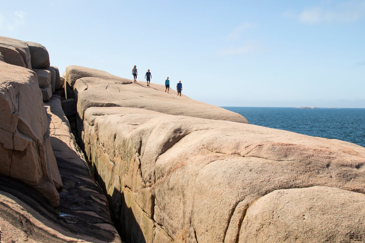
Sweden’s stunning coastal Kuststigen trail
Distance up to 234 milesDuration 2-5+ days
The Kuststigen trail along West Sweden’s Bohuslän coast is composed of 44 well-marked stages, some connected and others separate, most accessible by ferry or bus. The trail highlights the region’s sapphire seas, pink granite outcrops, brightly painted fishing villages, and many of its 8,000 idyllic islands and skerries, making it ideal for short sea-breezy summer hikes.
Sweden’s holiday season runs from July to mid-August, so visiting in late August to early September or the following June offers mild weather and fewer crowds.
Recommended sections include stage 22, a 7-mile loop around Ramsvikslandet, a peninsula nature reserve known as the Kingdom of Rocks. This can be combined with stage 24, a 10-mile linear route from Kungshamn to Tullboden, followed by a ferry to complete stage 25, a 6-mile circuit of Bohus-Malmön featuring ancient monuments and swimming lagoons. For city-accessible walks, take the free ferry from Gothenburg’s Lilla Varholmen terminal to Hönö to explore stages 1-3, totaling 17 miles of meadows, sandy beaches, swimming spots, and seabird habitats.
How to do it Further details are available online. Camping and bus information can also be found through relevant resources.