

Warmer Weather Brings Relief After Rainy Start to 2026
Spring is approaching, though for some it already feels like it has begun. Tuesday marked the warmest day of the year so far, with temperatures on Wednesday expected to rise even further.
A shift to mild south-westerly winds from the Atlantic has contributed to the temperature increase. Although the number of flood warnings has decreased, rainfall continues to affect parts of the UK.
How High Could Temperatures Get?
The recent influx of milder air has been a welcome change from the earlier cold and very wet conditions. This transition occurred over the weekend, with each home nation recording its highest temperature of the year to date.
On Tuesday, temperatures reached 16.4C (61.5F) in Epping Forest, but Wednesday is expected to be warmer. Increased sunshine in eastern England combined with a southerly breeze will likely push temperatures to 17-18C (63-64F).
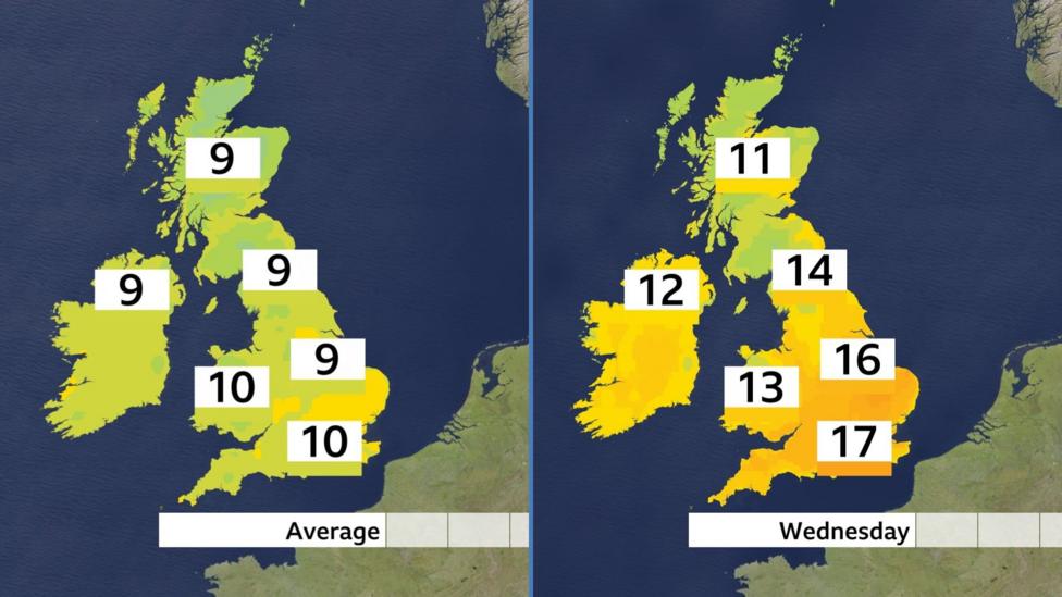
Further north and west, cloud cover and some rain are expected, though temperatures will remain above average. To provide context, the last time temperatures reached 18C was on 13 November 2025. The February record stands at 21.2C (70.2F), recorded on 26 February 2019 at Kew Gardens.

Wednesday is anticipated to be the warmest day of the week, with temperatures returning to near average by the end of February.
Could There Be More Flooding?
Some areas remain saturated after weeks of rain. Although recent rainfall has lessened over the past week, low-pressure systems and intermittent rain will continue to affect the UK as spring approaches.
The wettest conditions are expected over western hills, particularly in western Scotland, while eastern England will see relatively little rainfall—a pattern typical for this time of year.
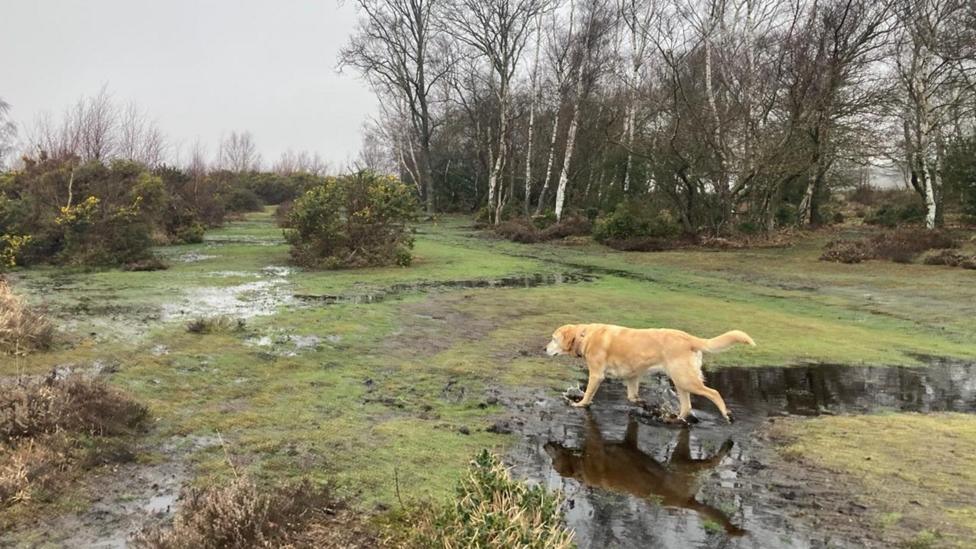
Given the saturated ground in parts of the UK, the risk of flooding remains a concern well into March.
Get in Touch
What are your worst weather experiences of this winter? Let us know.
Spring is the 'fastest-warming' season in the UK.


