

Wind Warnings Issued Across Northern UK
The Met Office has issued wind warnings for northern regions of the UK on Thursday, with potential transport disruptions expected.
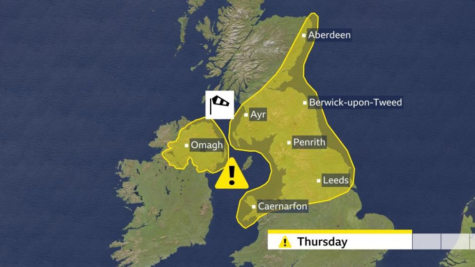
Yellow warnings are in effect for Scotland, Northern Ireland, northern England, North Wales, and the north Midlands.
The strongest winds will occur on and ahead of a cold front moving southwards throughout the day.
Following the passage of the cold front and its heavy rain, wind strength will rapidly diminish, with colder air moving in subsequently.
A yellow warning for strong winds covering North Wales, northern England, and southern and eastern Scotland will be active from 05:00 GMT until 20:00 GMT on Thursday. Northern Ireland's warning is valid from 06:00 to 12:00 GMT.
In Scotland and Northern Ireland, the most intense winds are expected during the morning. Widespread gales with gusts between 50-60 mph are forecast, with occasional stronger gusts possible in the Hebrides for a brief period. Some delays or cancellations of Scottish ferry services are likely, and passengers are advised to check travel updates before departure.
In northern England, the north Midlands, and North Wales, winds will strengthen through the morning, peaking in the afternoon. Gusts will commonly reach 50-60 mph, with some gusts potentially exceeding 70 mph briefly.
The strongest winds will not be confined to coastal areas or hilltops but will extend well east of the Pennines and the Cheviot Hills.

Transport disruption is possible, with high-sided vehicles particularly vulnerable. Northern sections of the M6, A68, and A1 may experience some of the most challenging driving conditions.
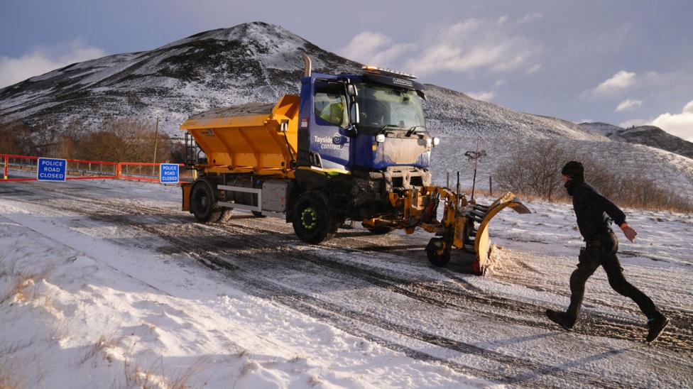
Mountain Snow Expected to Affect Northern UK
Frequent showers on Thursday night and into Friday will transition to wintry conditions in northern parts of the UK.
Snowfall is anticipated over high ground in Scotland, Northern Ireland, northern England, and North Wales above approximately 200 meters elevation. In Scotland's highest areas, snow could accumulate to 10-20 cm.
Friday will feature a mix of sunshine and showers, with showers most frequent in northern and western regions. Some showers may include hail and isolated thunder, but they are expected to be brief as gusty winds quickly move them across the skies.
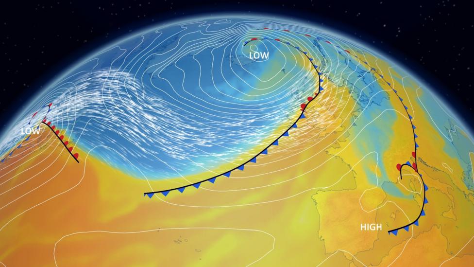
Powerful Atlantic Jet Stream Drives Windy Weather
The recent windy conditions are attributed to a very strong Atlantic jet stream, with winds reaching speeds of 220 mph. This jet stream has generated intense low-pressure areas northwest of the UK.
Although these low-pressure centers remain far to the northwest, they are close enough to bring zones of strong winds to the UK.
On Wednesday, gales were widespread in Scotland, with the strongest gusts affecting the islands. The highest gust recorded was 74 mph at South Uist Range in the Hebrides, with Orkney experiencing gusts up to 68 mph. These strong winds resulted in some ferry service cancellations.
The unsettled weather is expected to continue into the weekend, with further strong winds and wintry showers forecast for Sunday and Monday.
For the latest hour-by-hour forecast in your area, visit the BBC Weather website or use the BBC Weather app.
Additional Information
- UK winter not a record breaker despite floods and storms
- Temperatures exceed 19°C on the warmest day of the year so far in parts of the UK


