

Super Typhoon Sinlaku Approaches Mariana Islands
The Mariana Islands archipelago in the western Pacific, which includes the US territories of Guam and the Northern Mariana Islands, is preparing for severe weather early this week as Super Typhoon Sinlaku advances.
The storm began as a cluster of thunderstorms over the seas of Micronesia before intensifying into a tropical storm and subsequently a typhoon on Friday and Saturday.
During the weekend, Sinlaku shifted northwest while rapidly strengthening, with sustained winds reaching 150 mph on Sunday. Forecasts indicate the storm will continue to intensify as it moves through the western Pacific early this week, potentially reaching sustained winds of 165 mph.
A slight northward deviation in Sinlaku’s projected path reduces the likelihood of a direct strike on Guam, the most populous island and westernmost US territory. Instead, the islands of Saipan and Tinian are expected to experience the most severe weather conditions.

The National Weather Service in Guam has issued multiple warnings for the Mariana Islands. The combination of Sinlaku’s intense winds and anticipated rainfall exceeding 300 mm between Monday and Thursday is expected to generate hazardous seas and storm surges prior to the storm’s arrival. These conditions are likely to be followed by flash flooding, mudslides, and wind-related damage.
Although typhoons can occur year-round in this region, the peak season typically spans June to November, making a typhoon of this magnitude in April notably uncommon.
With sustained winds surpassing 130 knots (150 mph), the Joint Typhoon Warning Center classifies Sinlaku as a super typhoon. If located in the North Atlantic, it would be equivalent to a category 4 hurricane, with the potential to escalate to category 5 at its peak. The terms “typhoon,” “hurricane,” and “cyclone” refer to the same meteorological phenomenon, with the terminology varying by region.
Recent Cyclone Activity in the South Pacific
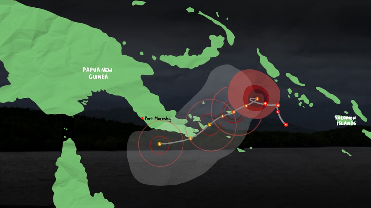
Meanwhile, in the South Pacific, shortly after Tropical Cyclone Maila struck Papua New Guinea last week, another weather system formed. Tropical Cyclone Vaianu developed on 5 April and moved southeastward, passing near Fiji without making landfall. It was later reclassified as an extratropical cyclone—not due to weakening, as average winds remained around 65 mph, but because of a structural change.
As Vaianu moved over New Zealand, red warnings for strong winds were issued over the weekend. Some areas experienced gusts up to 80 mph, resulting in widespread power outages and evacuations. The cyclone also generated massive ocean swells that battered New Zealand’s north coast, with one buoy recording an 11-meter wave.


